MyTopo
Italy Texas US Topo Map
Couldn't load pickup availability
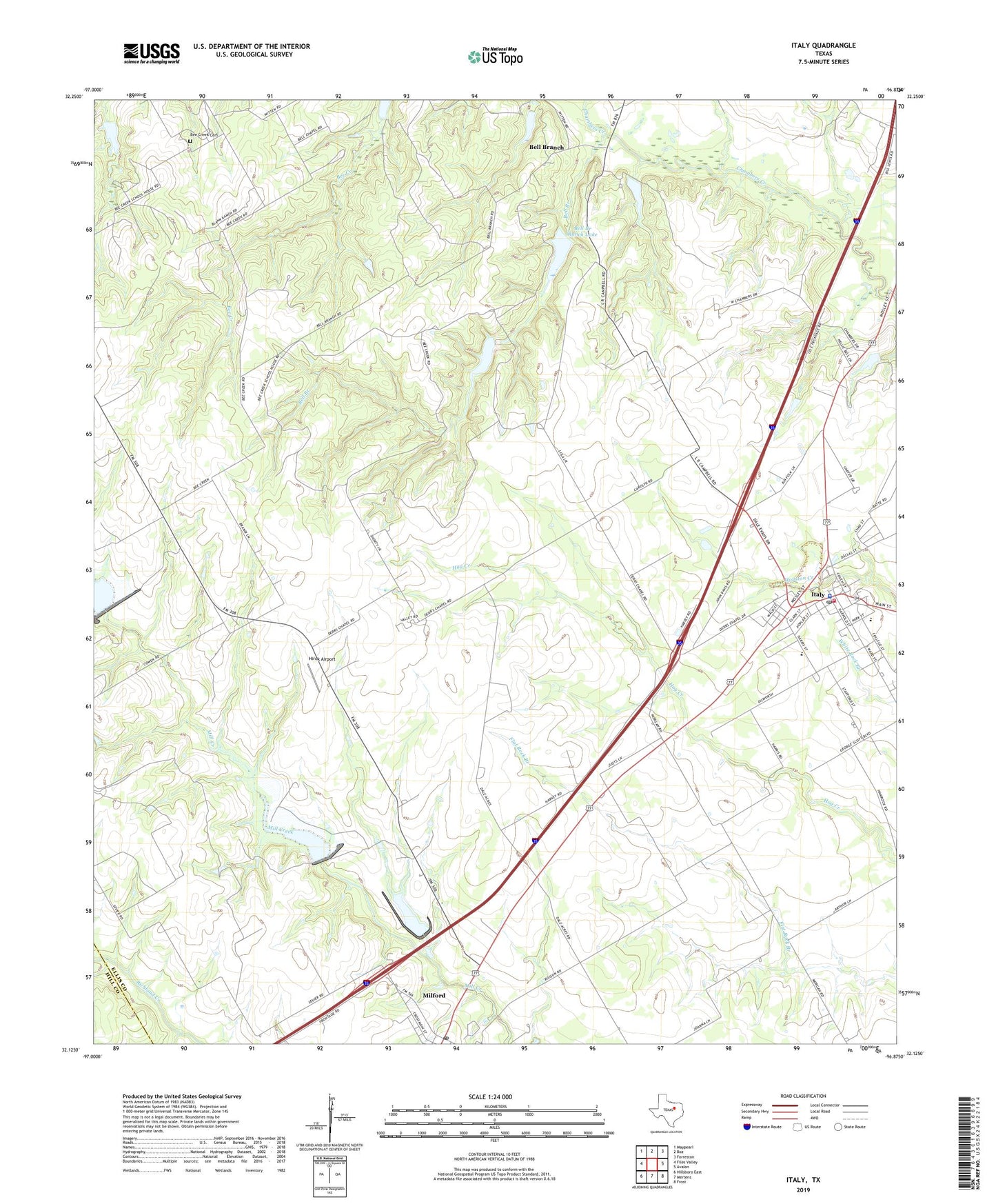
2022 topographic map quadrangle Italy in the state of Texas. Scale: 1:24000. Based on the newly updated USGS 7.5' US Topo map series, this map is in the following counties: Ellis, Hill. The map contains contour data, water features, and other items you are used to seeing on USGS maps, but also has updated roads and other features. This is the next generation of topographic maps. Printed on high-quality waterproof paper with UV fade-resistant inks.
Quads adjacent to this one:
West: Files Valley
Northwest: Maypearl
North: Boz
Northeast: Forreston
East: Avalon
Southeast: Frost
South: Mertens
Southwest: Hillsboro East
This map covers the same area as the classic USGS quad with code o32096b8.
Contains the following named places: Bee Creek Cemetery, Bell Branch, Bell Branch Church, Bell Branch Ranch Dam, Bell Branch Ranch Lake, Center Point, Dale Acres Airport, Dam Number 97, Dam Number 98, Dam Number 98A, Derrs Chapel, First Baptist Church, Hirok Airport, Italy, Italy City Hall, Italy Division, Italy Police Department, Italy Post Office, Italy Volunteer Fire Department and Emergency Medical Services, Milford Post Office, Plum Grove, Soil Conservation Service Site 79a Dam, Soil Conservation Service Site 79a Reservoir, Soil Conservation Service Site 83 Dam, Soil Conservation Service Site 83 Reservoir, Soil Conservation Service Site 85b Dam, Soil Conservation Service Site 85b Reservoir, Soil Conservation Service Site 86 Dam, Soil Conservation Service Site 86 Reservoir, Soil Conservation Service Site 97 Dam, Soil Conservation Service Site 97 Reservoir, Soil Conservation Service Site 98 Dam, Soil Conservation Service Site 98 Reservoir, Soil Conservation Service Site 98a Dam, Soil Conservation Service Site 98a Reservoir, Stafford Elementary School, Stafford School, Town of Italy, ZIP Code: 76670