MyTopo
Fruitvale Texas US Topo Map
Couldn't load pickup availability
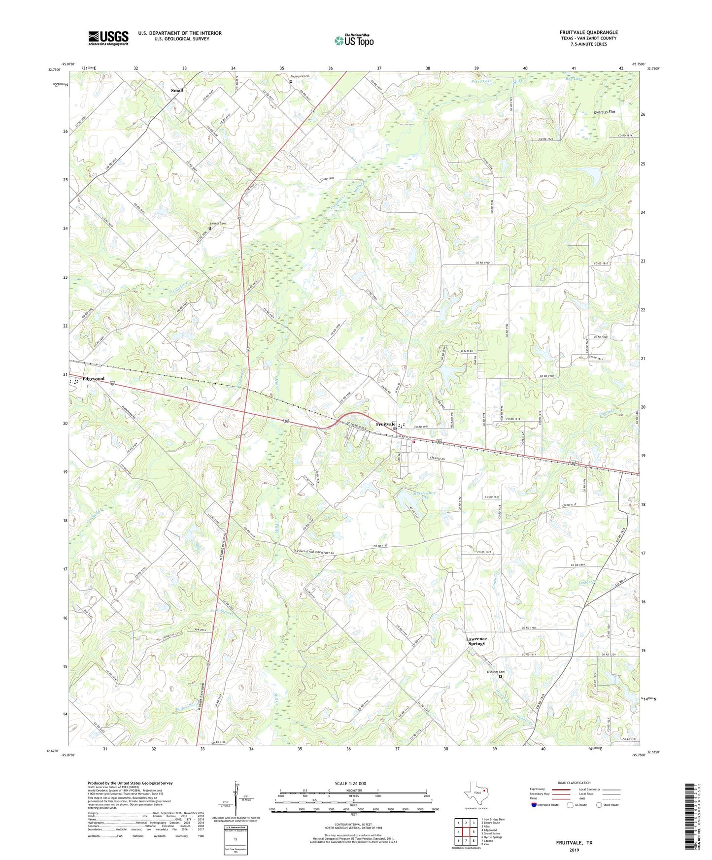
2019 topographic map quadrangle Fruitvale in the state of Texas. Scale: 1:24000. Based on the newly updated USGS 7.5' US Topo map series, this map is in the following counties: Van Zandt. The map contains contour data, water features, and other items you are used to seeing on USGS maps, but also has updated roads and other features. This is the next generation of topographic maps. Printed on high-quality waterproof paper with UV fade-resistant inks.
Quads adjacent to this one:
West: Edgewood
Northwest: Iron Bridge Dam
North: Emory South
Northeast: Alba
East: Grand Saline
Southeast: Van
South: Canton
Southwest: Myrtle Springs
Contains the following named places: Barrett Cemetery, Bog Lake, Bratcher Cemetery, Buffalo Creek, City of Fruitvale, Creagleville Church, Crooked Creek, Edgewood Division, Fruitvale, Fruitvale High School, Fruitvale Middle School, Fruitvale Oil Field, Fruitvale Post Office, Fruitvale Volunteer Fire Department, Giladon Creek, Good Hope Church, Herrin Branch, Lawrence Springs, Musslewhite Lake, Musslewhite Lake Dam, Overcup Flat, Pleasant Union Church, Posey Lake, Round Flat Church, Small, Toumbes - Venible Cemetery, Willow Branch, ZIP Codes: 75117, 75127