MyTopo
Van Texas US Topo Map
Couldn't load pickup availability
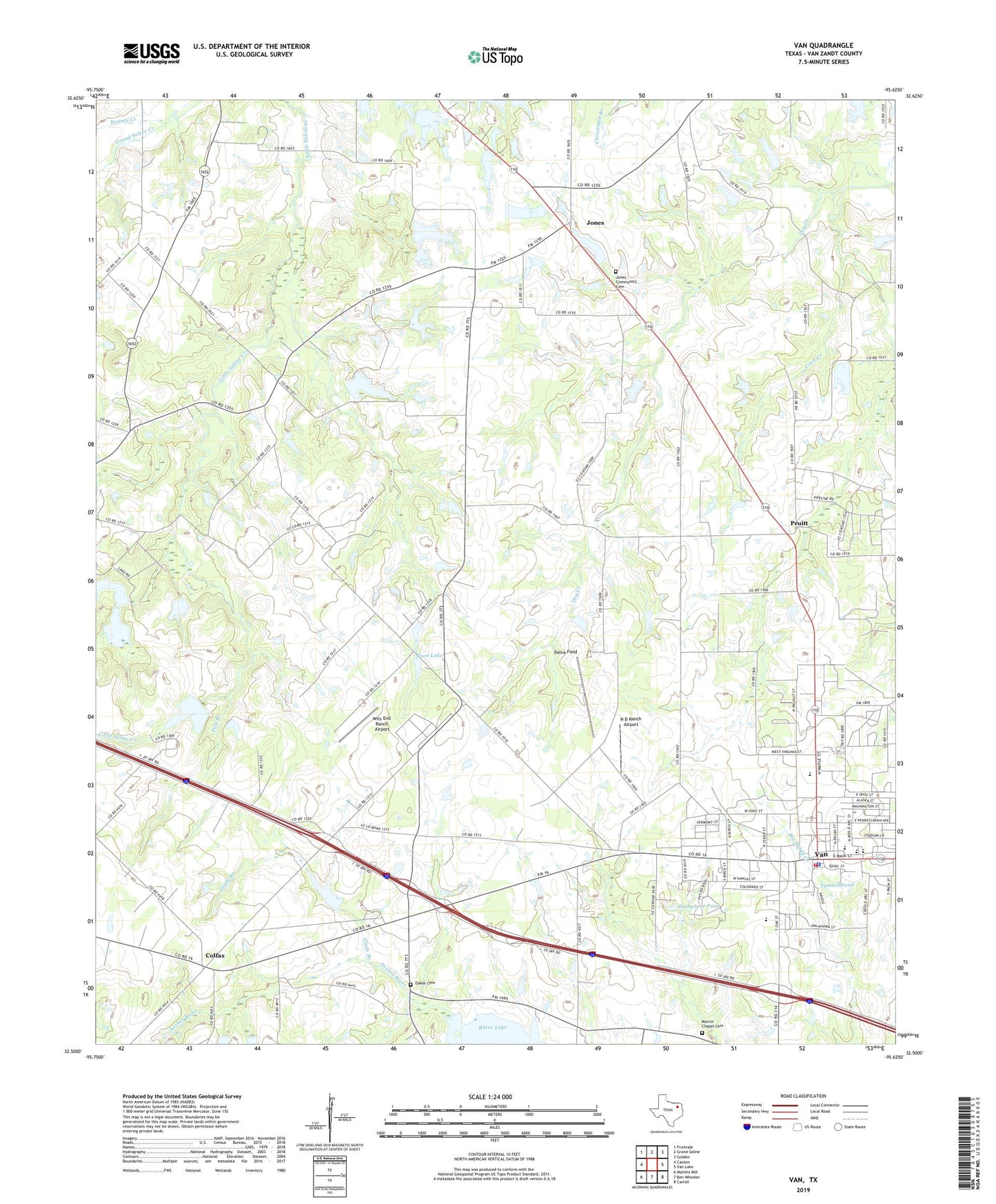
2022 topographic map quadrangle Van in the state of Texas. Scale: 1:24000. Based on the newly updated USGS 7.5' US Topo map series, this map is in the following counties: Van Zandt. The map contains contour data, water features, and other items you are used to seeing on USGS maps, but also has updated roads and other features. This is the next generation of topographic maps. Printed on high-quality waterproof paper with UV fade-resistant inks.
Quads adjacent to this one:
West: Canton
Northwest: Fruitvale
North: Grand Saline
Northeast: Golden
East: Van Lake
Southeast: Carroll
South: Ben Wheeler
Southwest: Martins Mill
This map covers the same area as the classic USGS quad with code o32095e6.
Contains the following named places: City of Van, Clower, Colfax, Colfax Cemetery, Coon Creek, Corinth, Corinth Church, Delva Field, East Center Church, Enas Pond, Glade Branch, Humphree Pond, Jones, Jones Community Cemetery, Magers Pond, Marvin Chapel Cemetery, Metzger Dam Number 1, Metzger Dam Number 2, Metzger Dam Number 3, Metzger Lake Number 2, Metzger Lake Number 3, N D Ranch Airport, Neill Lake, Neill Lake Dam, Oakes Cemetery, Owlett Green, Poco Club Dam, Poco Golf Course, Poco Lake, Pole Branch, Pruitt, Tunnell Pond, Van, Van Area Oil and Historical Museum, Van City Hall, Van Division, Van Fire Department, Van High School, Van Intermediate School, Van Junior High School, Van Oil Field, Van Police Department, Van Post Office, Wits End Ranch Airport, ZIP Code: 75790