MyTopo
Gause Texas US Topo Map
Couldn't load pickup availability
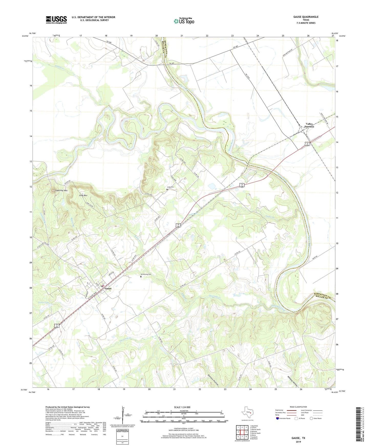
2019 topographic map quadrangle Gause in the state of Texas. Scale: 1:24000. Based on the newly updated USGS 7.5' US Topo map series, this map is in the following counties: Milam, Robertson. The map contains contour data, water features, and other items you are used to seeing on USGS maps, but also has updated roads and other features. This is the next generation of topographic maps. Printed on high-quality waterproof paper with UV fade-resistant inks.
Quads adjacent to this one:
West: Hanover
Northwest: Maysfield
North: Calvert
Northeast: Hearne North
East: Hearne South
Southeast: Mumford
South: Goodwill
Southwest: Milano
Contains the following named places: Armstrong Cemetery, Beaver Branch, Church of God and Christ, Dollar Creek, Gause, Gause Census Designated Place, Gause Post Office, Gause Volunteer Fire Department, Green Lake, Green Lake Dam, Little River, Long Cemetery, Long Mountain, McLaughlin Creek, Mount Tabor Church, Nashville, Polecat Creek, Port Sullivan, Stephen Chapel, Sugarloaf Mountain, Taylor Branch, Threemile Creek, Tidwell School, Trinity Church, Valley Junction, ZIP Code: 77857