MyTopo
Hearne North Texas US Topo Map
Couldn't load pickup availability
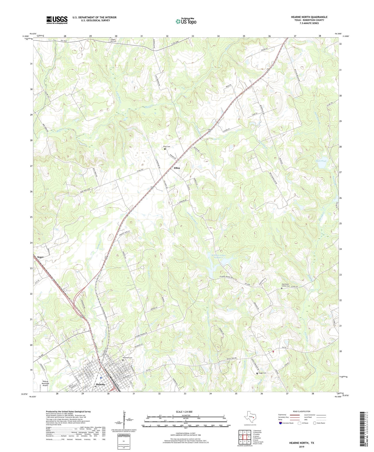
2022 topographic map quadrangle Hearne North in the state of Texas. Scale: 1:24000. Based on the newly updated USGS 7.5' US Topo map series, this map is in the following counties: Robertson. The map contains contour data, water features, and other items you are used to seeing on USGS maps, but also has updated roads and other features. This is the next generation of topographic maps. Printed on high-quality waterproof paper with UV fade-resistant inks.
Quads adjacent to this one:
West: Calvert
Northwest: Hammond
North: Owensville
Northeast: Franklin
East: Wheelock
Southeast: Dunn Creek
South: Hearne South
Southwest: Gause
This map covers the same area as the classic USGS quad with code o30096h5.
Contains the following named places: Bethany Church, Black Jack, Blackjack Volunteer Fire Department, Blackshear Elementary School, Calvary Church, Chapel Hill Church, City of Hearne, Duck Pond, Duck Pond Branch, East Side Elementary School, Eastside Park, Elliot, Elliot Cemetery, Hamilton Chapel, Hammond Colony Cemetery, Hearne, Hearne City Hall, Hearne Police Department, Hearne Post Office, Knox Branch, Little Bethel Church, Little Mud Creek, McGuire Lake, McGuire Lakes Number 1, McGuire Lakes Number 1 Dam, McGuire Lakes Number 2, McGuire Lakes Number 2 Dam, Mount Calvary Church, Norwood Cemetery, Putney Branch, Robert C Allen House, Robertson County Constable's Office Precinct 2, Saint Emmanuel Church, Saint Marys Church, Saint Paul Church, Seger, Suggs Cemetery, Threemile Creek, True Light Church