MyTopo
Hearne South Texas US Topo Map
Couldn't load pickup availability
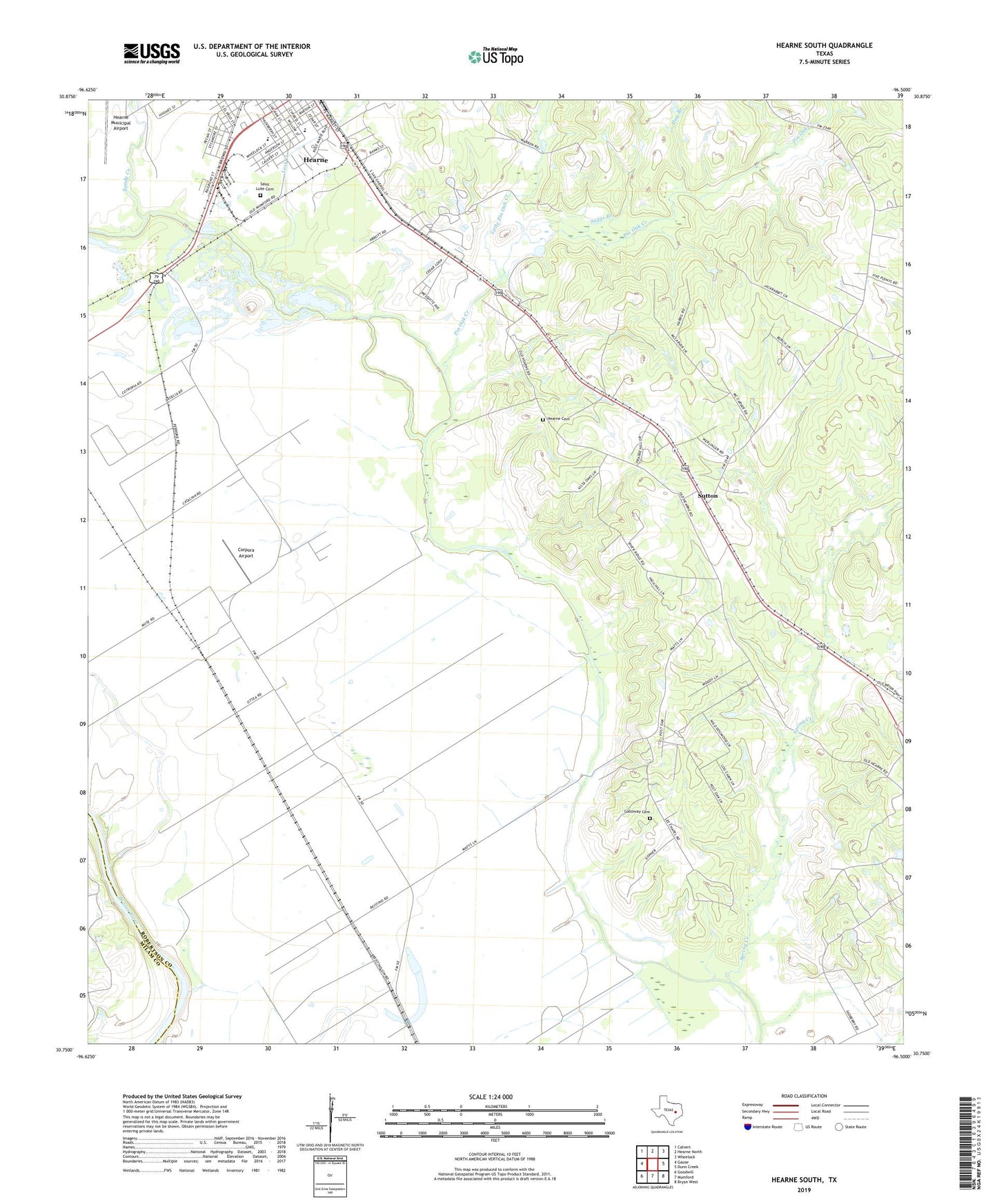
2022 topographic map quadrangle Hearne South in the state of Texas. Scale: 1:24000. Based on the newly updated USGS 7.5' US Topo map series, this map is in the following counties: Robertson, Milam. The map contains contour data, water features, and other items you are used to seeing on USGS maps, but also has updated roads and other features. This is the next generation of topographic maps. Printed on high-quality waterproof paper with UV fade-resistant inks.
Quads adjacent to this one:
West: Gause
Northwest: Calvert
North: Hearne North
Northeast: Wheelock
East: Dunn Creek
Southeast: Bryan West
South: Mumford
Southwest: Goodwill
This map covers the same area as the classic USGS quad with code o30096g5.
Contains the following named places: Blackshear High School, Corpora Airport, Dunn Creek, Five Point Church, Galloway Cemetery, Hay Branch, Hearne Cemetery, Hearne Division, Hearne High School, Hearne Junior High School, Hearne Municipal Airport, KHRN-FM (Hearne), Lees Chapel, Little Pin Oak Creek, Lost Creek, New Elam Church, Nicholas, Old Elam Church, Pin Oak Creek, Saint Luke Cemetery, Saint Mark Church, Sandy Creek, Spring Creek, Suggs Branch, Sutton, Tatsie, Tatsie Crossing, Wilson Chapel, ZIP Code: 77859