MyTopo
Glenwood Texas US Topo Map
Couldn't load pickup availability
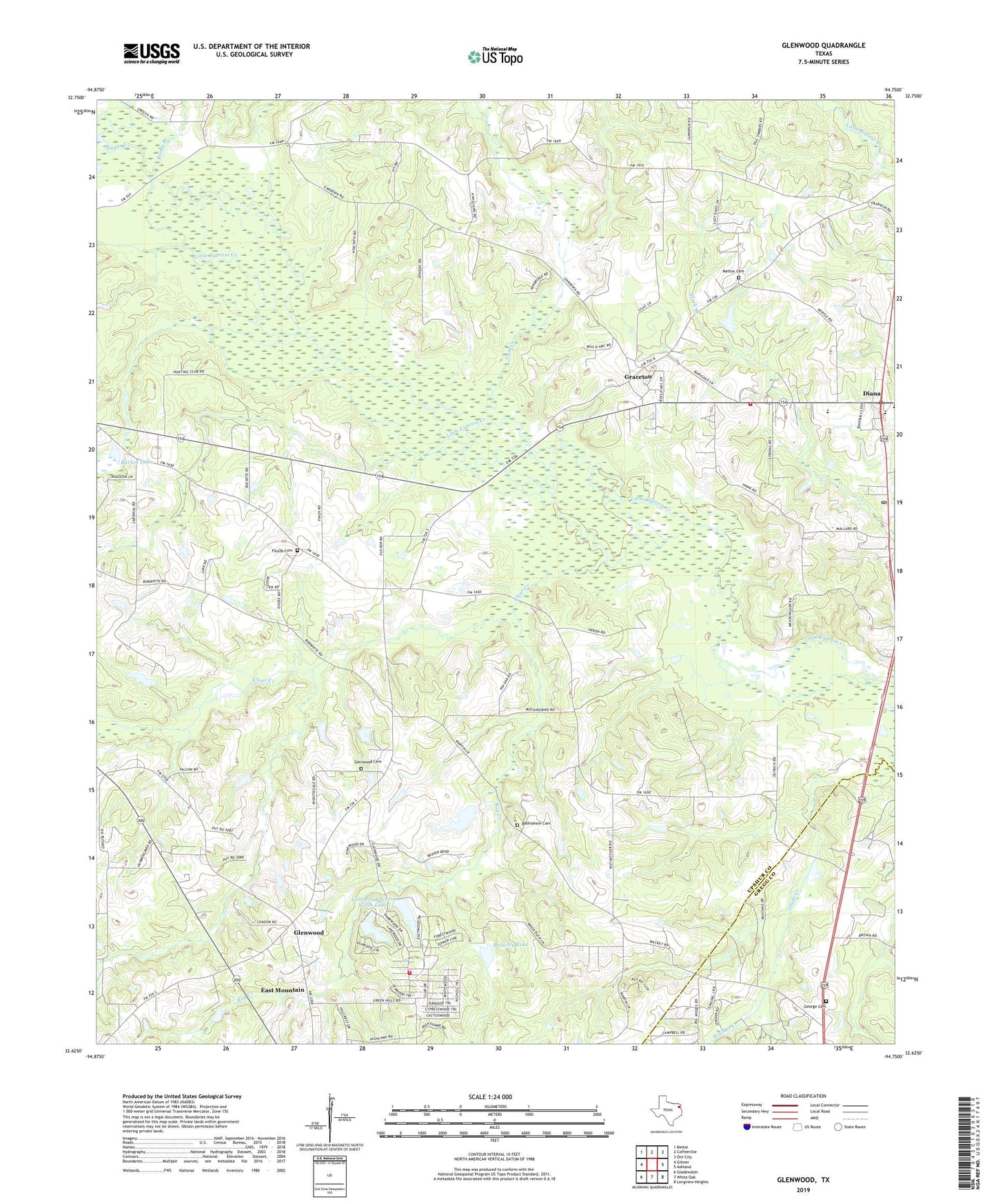
2019 topographic map quadrangle Glenwood in the state of Texas. Scale: 1:24000. Based on the newly updated USGS 7.5' US Topo map series, this map is in the following counties: Upshur, Gregg. The map contains contour data, water features, and other items you are used to seeing on USGS maps, but also has updated roads and other features. This is the next generation of topographic maps. Printed on high-quality waterproof paper with UV fade-resistant inks.
Quads adjacent to this one:
West: Gilmer
Northwest: Bettie
North: Coffeeville
Northeast: Ore City
East: Ashland
Southeast: Longview Heights
South: White Oak
Southwest: Gladewater
Contains the following named places: Barton Lake, Barton Lake Dam, Bethel, Bethlehem, Bethlehem Cemetery, Bog Creek, Brawley Lake, Brawley Lake Dam, Clark Branch, Clear Creek, Diana, Diana Post Office, Diana Volunteer Fire Department, Dixon Lake, Dixon Lake Dam, Floyds Cemetery, George Cemetery, Glenwood, Glenwood Acres North Lake, Glenwood Acres North Lake Dam, Glenwood Acres Volunteer Fire Department, Glenwood Acres West Lake, Glenwood Acres West Lake Dam, Glenwood Cemetery, Graceton, Gum Creek, Indian Rock, Lake Providence Church, Lester Lake, Lester Lake Dam, Mattox Cemetery, McClellan Lake, McClellan Lake Dam, New Bethlehem School, New Diana Oil Field, New Hope Church, Owens Lake, Owens Lake Dam, Pine Grove Tabernacle, Rocky Branch, Sugar Creek, Valley View, Valley View School, Witcher Creek, Woodland Church, ZIP Code: 75645