MyTopo
Ashland Texas US Topo Map
Couldn't load pickup availability
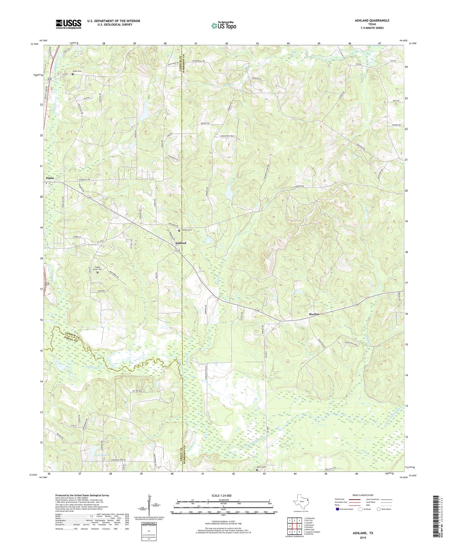
2022 topographic map quadrangle Ashland in the state of Texas. Scale: 1:24000. Based on the newly updated USGS 7.5' US Topo map series, this map is in the following counties: Harrison, Upshur, Gregg. The map contains contour data, water features, and other items you are used to seeing on USGS maps, but also has updated roads and other features. This is the next generation of topographic maps. Printed on high-quality waterproof paper with UV fade-resistant inks.
Quads adjacent to this one:
West: Glenwood
Northwest: Coffeeville
North: Ore City
Northeast: Lassater
East: Harleton
Southeast: Hallsville
South: Longview Heights
Southwest: White Oak
This map covers the same area as the classic USGS quad with code o32094f6.
Contains the following named places: Ashland, Ashland Cemetery, Beachman Creek, Bluff Spring Lake, Bluff Spring Lake Dam, Caney Creek, Darnell Dam Number 2, Darnell Lake Number 2, Davidson Chapel, Davis Cemetery, Eagle Creek, French Dam, French Lake, Glade Creek, James, Jones Cemetery, Little Cypress Creek, Little Walnut Creek, Macedonia Church, Morton, Old Diana, Panther Creek, Shady Grove Cemetery, Shady Grove Church, Simmons Church, Smyrna, Walnut Creek, Walnut Creek Church, ZIP Code: 75640