MyTopo
Bettie Texas US Topo Map
Couldn't load pickup availability
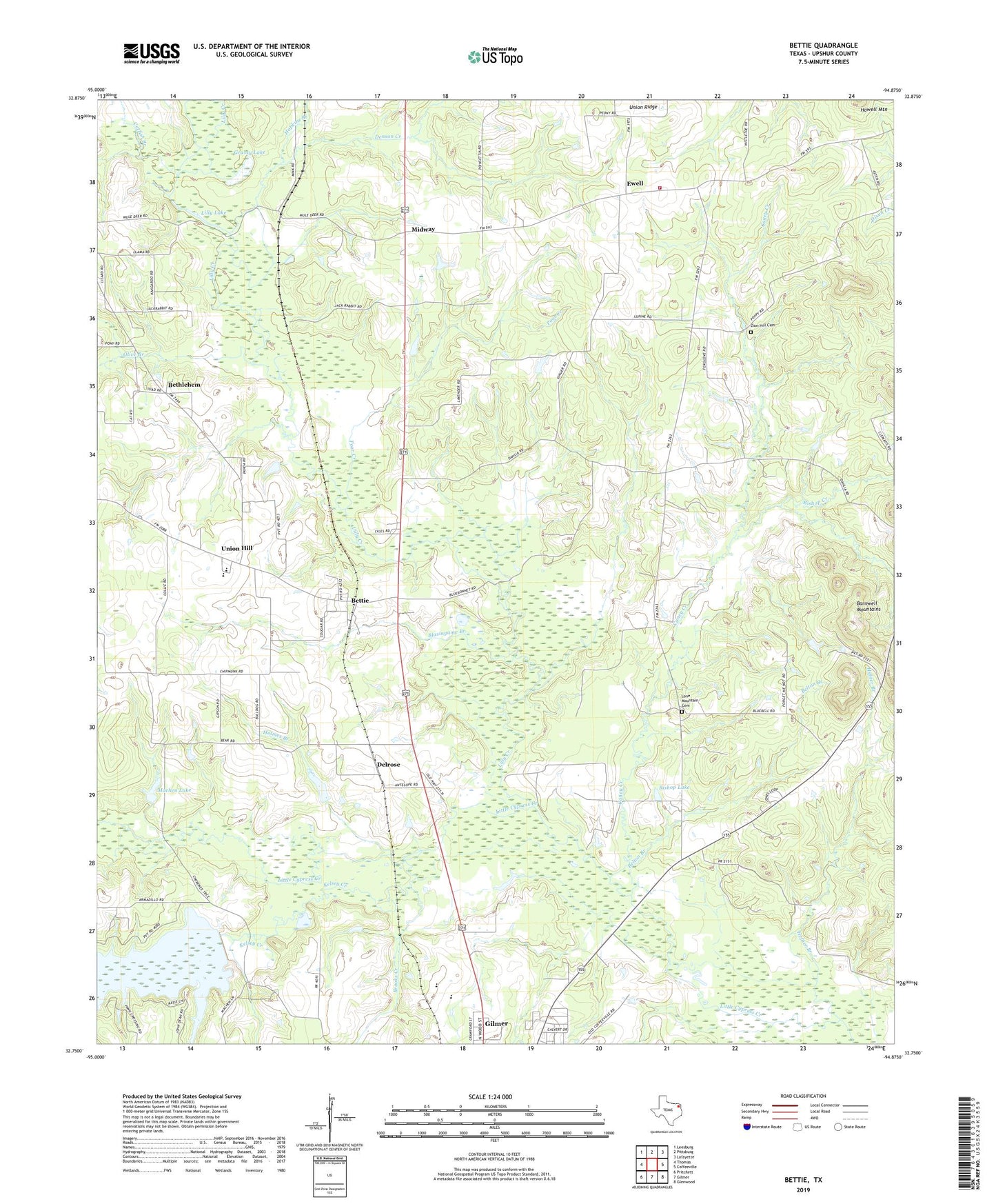
2022 topographic map quadrangle Bettie in the state of Texas. Scale: 1:24000. Based on the newly updated USGS 7.5' US Topo map series, this map is in the following counties: Upshur. The map contains contour data, water features, and other items you are used to seeing on USGS maps, but also has updated roads and other features. This is the next generation of topographic maps. Printed on high-quality waterproof paper with UV fade-resistant inks.
Quads adjacent to this one:
West: Thomas
Northwest: Leesburg
North: Pittsburg
Northeast: Lafayette
East: Coffeeville
Southeast: Glenwood
South: Gilmer
Southwest: Pritchett
This map covers the same area as the classic USGS quad with code o32094g8.
Contains the following named places: Belton Branch, Bethlehem, Bettie, Bettie Division, Bishop Creek, Bishop Lake, Blasingame Branch, Brooks Creek, Camp Gilmont, Caney Creek, Catfish Branch, Cherokee Missionary Church, Concord, Concord Missionary Church, Delrose, Denson Creek, Ewell, Ewell Lake, Ewell Lake Dam, Ewell Volunteer Fire Department, Friendship, Gilmont Lookout, Grassy Lake, Hefner Branch, Holmes Branch, Hopkins Branch, Kelsey Creek, Lilly Creek, Lilly Lake, Lone Mountain Cemetery, Lone Pine, Machen Lake, Machen Lake Dam, Midway, Oak Hill Church, Olive Branch, Poor Creek, Smith Siding, Union Hill, Union Ridge, Union Ridge Church, Union Ridge Community Center, Youngs Chapel, Zion Hill Cemetery, Zion Hill Church, ZIP Code: 75644