MyTopo
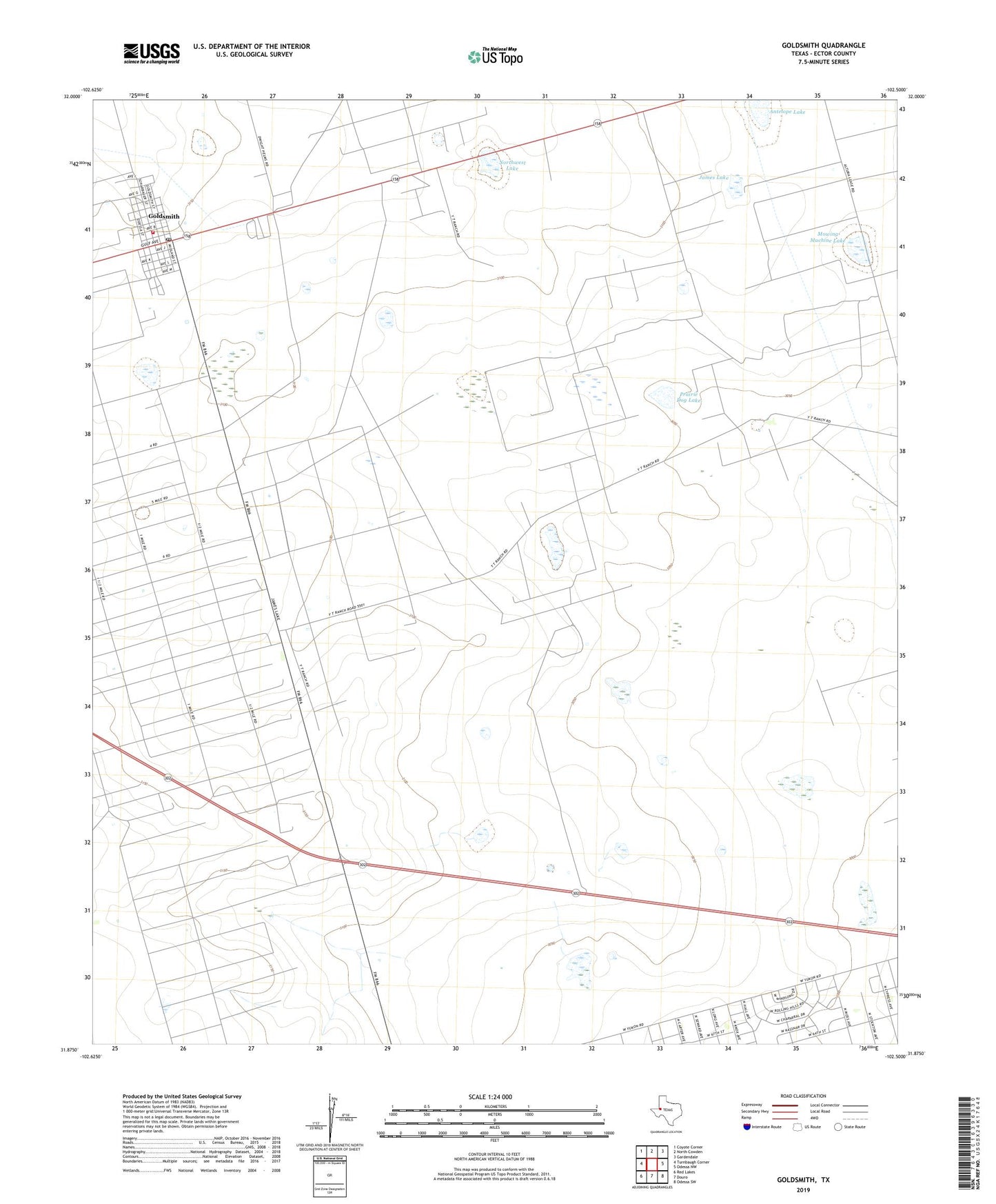
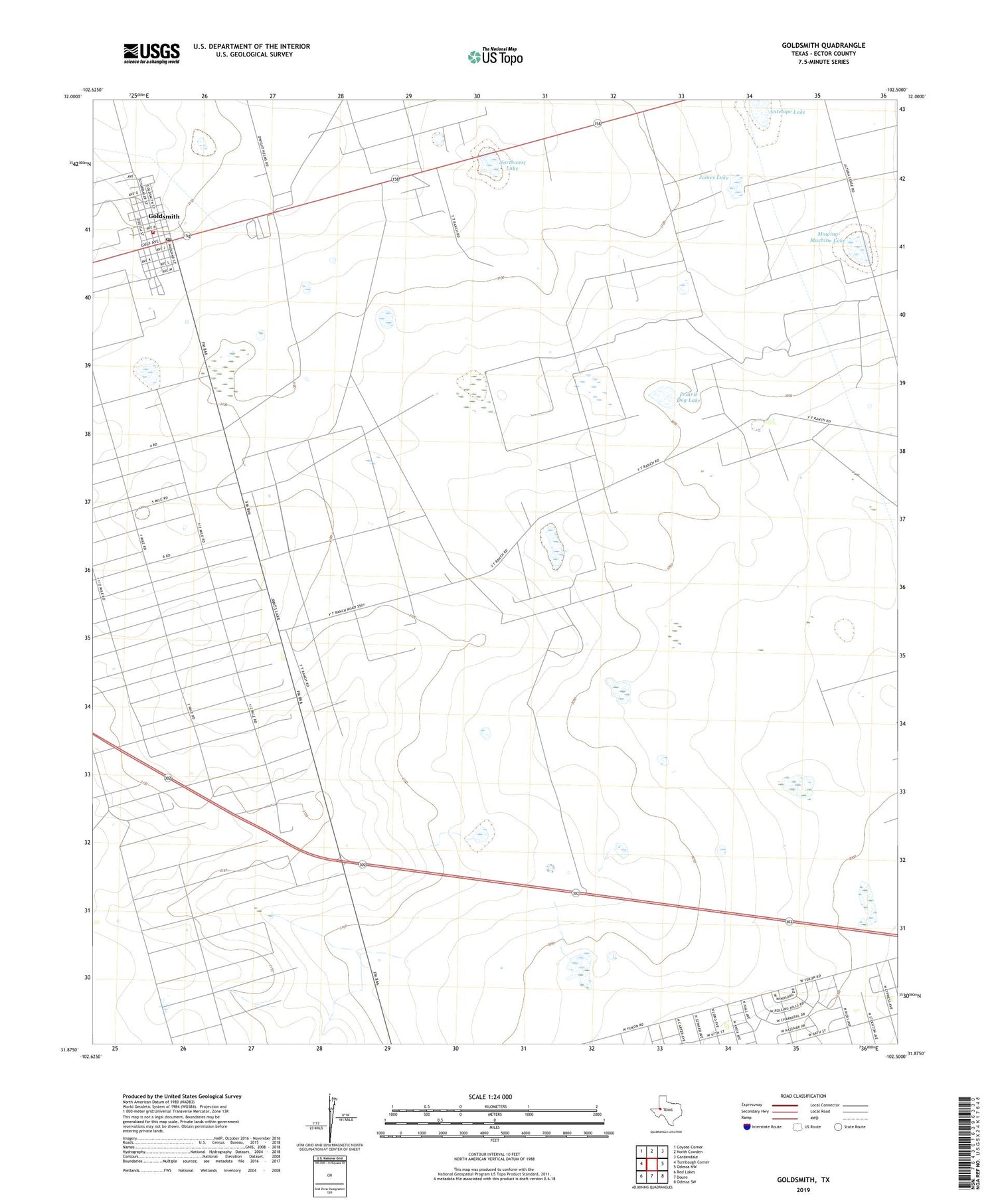
Goldsmith Texas US Topo Map
Couldn't load pickup availability
2019 topographic map quadrangle Goldsmith in the state of Texas. Scale: 1:24000. Based on the newly updated USGS 7.5' US Topo map series, this map is in the following counties: Ector. The map contains contour data, water features, and other items you are used to seeing on USGS maps, but also has updated roads and other features. This is the next generation of topographic maps. Printed on high-quality waterproof paper with UV fade-resistant inks.
Quads adjacent to this one:
West: Turnbaugh Corner
Northwest: Coyote Corner
North: North Cowden
Northeast: Gardendale
East: Odessa NW
Southeast: Odessa SW
South: Douro
Southwest: Red Lakes
Contains the following named places: Antelope Lake, Bull Pasture Windmill, Cherry Windmill, City of Goldsmith, Collins Windmill, Coyote Lake, Donnelly North Oil Field, Donnelly Oil Field, Goldsmith, Goldsmith City Hall, Goldsmith Post Office, Goldsmith Volunteer Fire Department, Gulf Camp Windmill, James Lake, Johnson Oil Field, KENT-FM (Odessa), Mowing Machine Lake, New Windmill, North Burkett Windmill, North Clyde Windmill, Northwest Lake, Northwest Windmill, Old Burkett Windmill, Plover Lake, Prairie Dog Lake, Registered Pasture Windmill, Six Section Windmill, South Burkett Windmill, West Burkett Windmill, West Windmill