MyTopo
North Cowden Texas US Topo Map
Couldn't load pickup availability
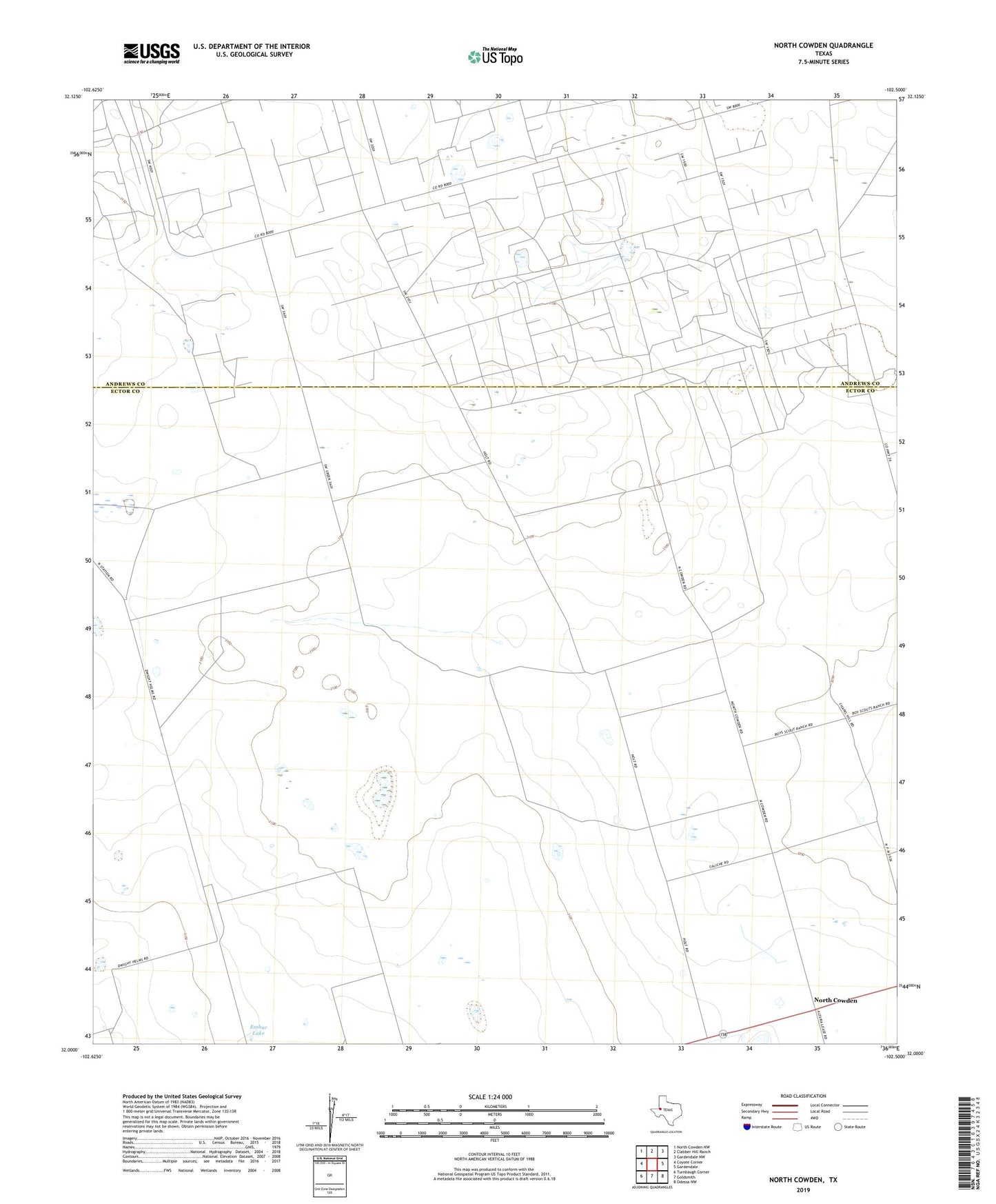
2022 topographic map quadrangle North Cowden in the state of Texas. Scale: 1:24000. Based on the newly updated USGS 7.5' US Topo map series, this map is in the following counties: Ector, Andrews. The map contains contour data, water features, and other items you are used to seeing on USGS maps, but also has updated roads and other features. This is the next generation of topographic maps. Printed on high-quality waterproof paper with UV fade-resistant inks.
Quads adjacent to this one:
West: Coyote Corner
Northwest: North Cowden NW
North: Clabber Hill Ranch
Northeast: Gardendale NW
East: Gardendale
Southeast: Odessa NW
South: Goldsmith
Southwest: Turnbaugh Corner
This map covers the same area as the classic USGS quad with code o32102a5.
Contains the following named places: Alley Oople Windmill, Comanche Trails Camp, Conger Ranch, East Goldsmith Oil Field, East Windmill, Embar Lake, Flynt Ranch, Giffon Windmill, Line Windmill, North Cowden, North Cowden Deep Oil Field, North Cowden Oil Field, Rich Uncle Windmill, South Windmill, Trap Windmill, White Windmill