
MyTopo
Grow NW Texas US Topo Map
Couldn't load pickup availability
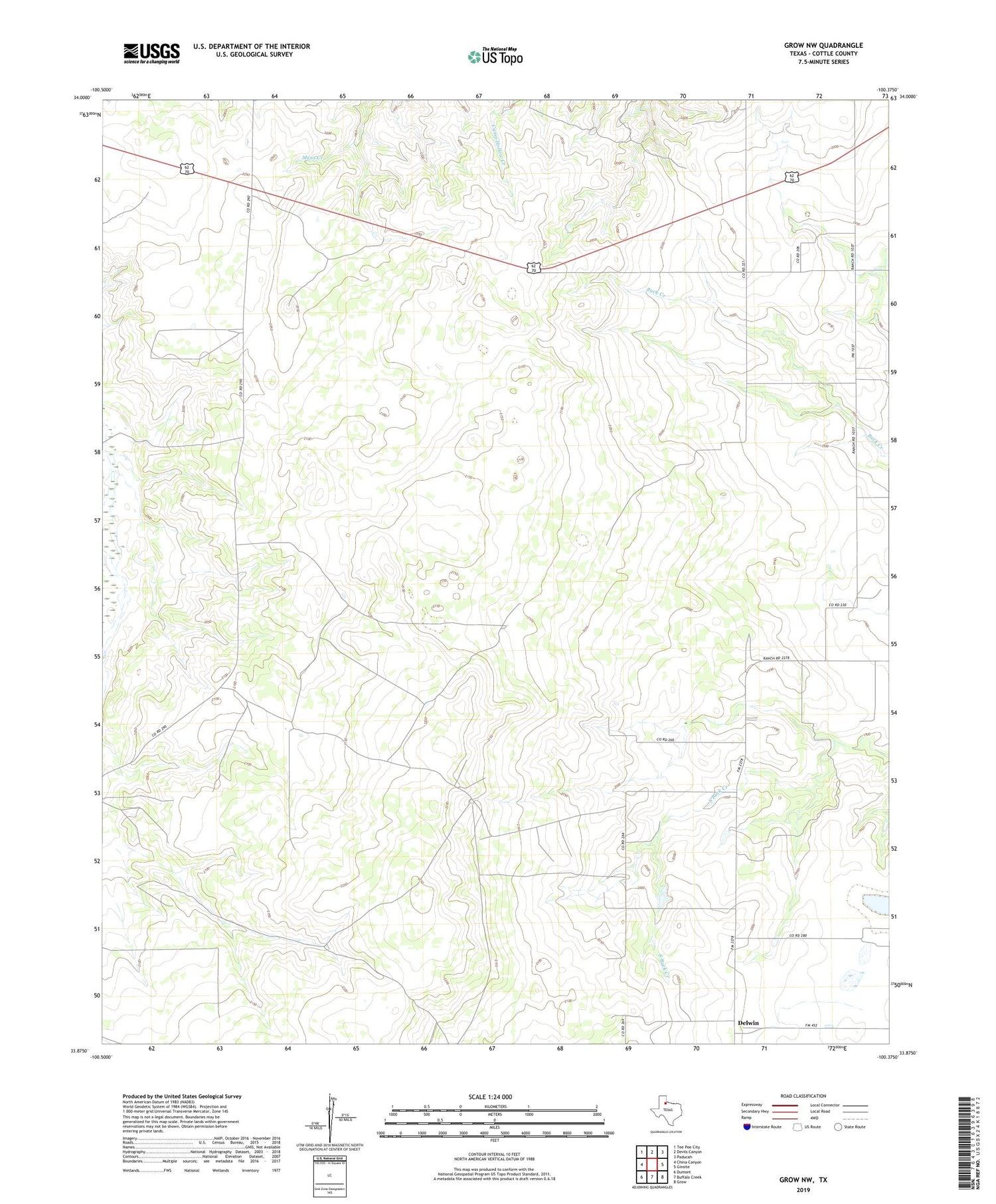
2019 topographic map quadrangle Grow NW in the state of Texas. Scale: 1:24000. Based on the newly updated USGS 7.5' US Topo map series, this map is in the following counties: Cottle. The map contains contour data, water features, and other items you are used to seeing on USGS maps, but also has updated roads and other features. This is the next generation of topographic maps. Printed on high-quality waterproof paper with UV fade-resistant inks.
Quads adjacent to this one:
West: China Canyon
Northwest: Tee Pee City
North: Devils Canyon
Northeast: Paducah
East: Ginsite
Southeast: Grow
South: Buffalo Creek
Southwest: Dumont
Contains the following named places: Bull Pasture Windmill, Day Windmill, Delwin, Dry Lake Windmill, E Camp Windmill, East Herd Windmill, Farm Trap Windmill, Ford Windmill, North Shinnery Windmill, Shorty Smock Windmill, Star Pool Windmill, Steel Pen Windmill, Valley View, White Flat Windmill


