MyTopo
Hayrick Mountain Texas US Topo Map
Couldn't load pickup availability
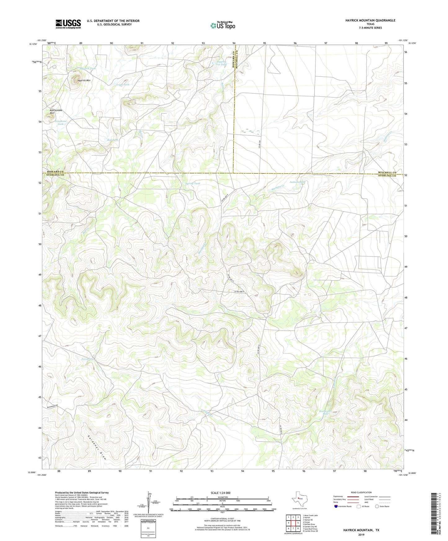
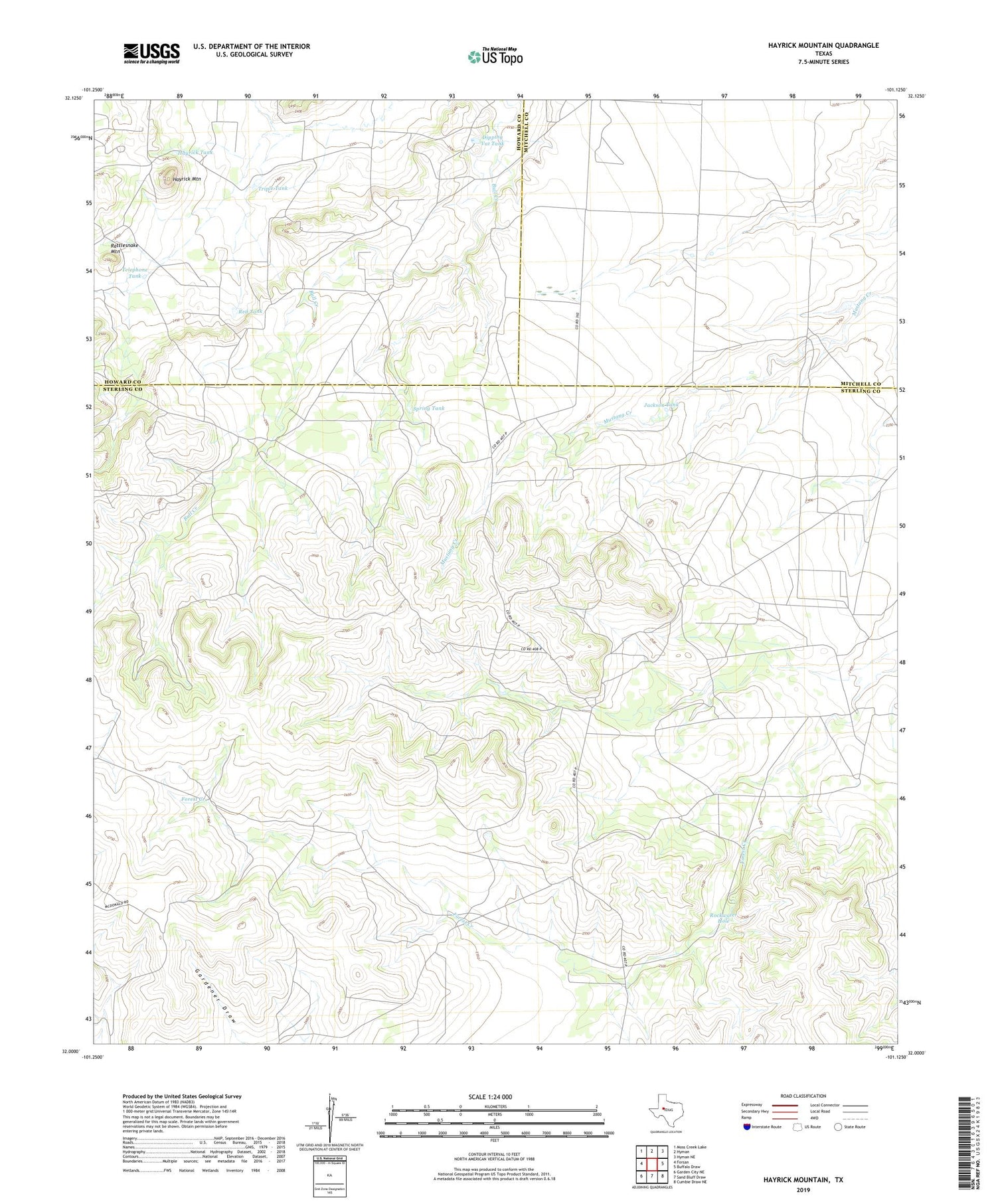
2019 topographic map quadrangle Hayrick Mountain in the state of Texas. Scale: 1:24000. Based on the newly updated USGS 7.5' US Topo map series, this map is in the following counties: Sterling, Howard, Mitchell. The map contains contour data, water features, and other items you are used to seeing on USGS maps, but also has updated roads and other features. This is the next generation of topographic maps. Printed on high-quality waterproof paper with UV fade-resistant inks.
Quads adjacent to this one:
West: Forsan
Northwest: Moss Creek Lake
North: Hyman
Northeast: Hyman NE
East: Buffalo Draw
Southeast: Cumbie Draw NE
South: Sand Bluff Draw
Southwest: Garden City NE
Contains the following named places: Boone Windmill, Cedar Windmill, Challenge Windmill, Coleman Windmill, Davis Windmill, Dipping Vat Tank, Doodle Bug Windmill, Finley Windmill, Garden Windmill, Happy Windmill, Hayrick Mountain, Hayrick Tank, Jackson Tank, North Windmill, Patsy Windmill, Perry Windmill, Phillip Windmill, Rattlesnake Mountain, Red Tank, Rockwater Hole, Spring Tank, Telephone Tank, Triple Tank