MyTopo
Hyman NE Texas US Topo Map
Couldn't load pickup availability
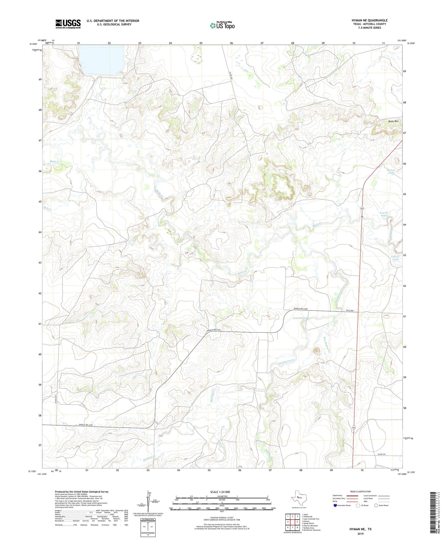
2022 topographic map quadrangle Hyman NE in the state of Texas. Scale: 1:24000. Based on the newly updated USGS 7.5' US Topo map series, this map is in the following counties: Mitchell. The map contains contour data, water features, and other items you are used to seeing on USGS maps, but also has updated roads and other features. This is the next generation of topographic maps. Printed on high-quality waterproof paper with UV fade-resistant inks.
Quads adjacent to this one:
West: Hyman
Northwest: Iatan
North: Westbrook
Northeast: Lake Colorado City
East: Spade Ranch
Southeast: McWhorter Mountain
South: Buffalo Draw
Southwest: Hayrick Mountain
This map covers the same area as the classic USGS quad with code o32101b1.
Contains the following named places: Bull Creek, Calf Creek Tank, Calf Pasture Well, Dry Hollow Creek, Ellwood Lake, Ellwood Lake Dam, Forest Creek, Hackberry Creek, Meteor Tank, Mitchell County Reservoir Dam, Mustang Creek, Red Dam, Tom Neff Lake, Tom Neff Lake Dam, Vowell Tank, White Dam