MyTopo
Hooks Texas US Topo Map
Couldn't load pickup availability
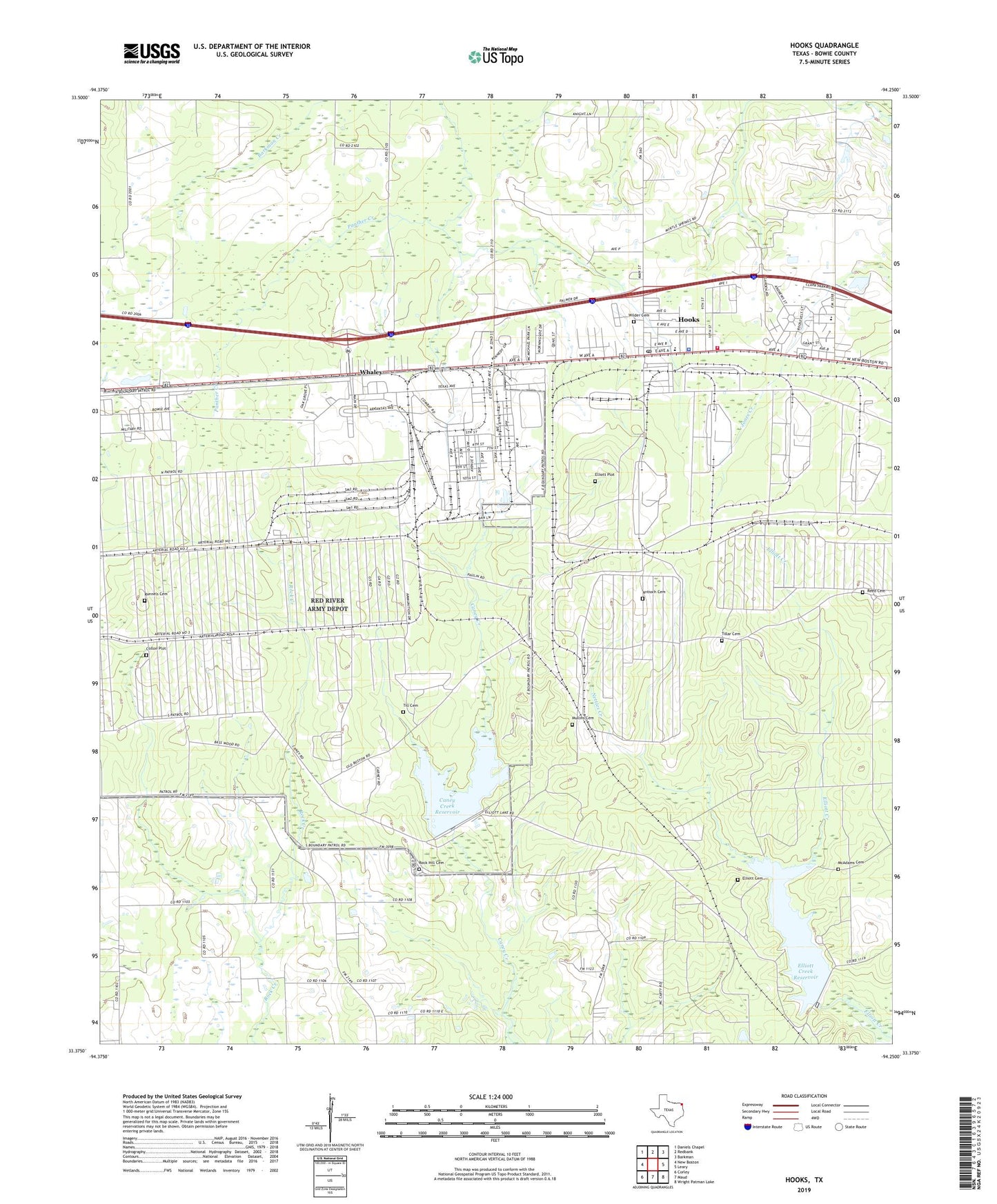
2019 topographic map quadrangle Hooks in the state of Texas. Scale: 1:24000. Based on the newly updated USGS 7.5' US Topo map series, this map is in the following counties: Bowie. The map contains contour data, water features, and other items you are used to seeing on USGS maps, but also has updated roads and other features. This is the next generation of topographic maps. Printed on high-quality waterproof paper with UV fade-resistant inks.
Quads adjacent to this one:
West: New Boston
Northwest: Daniels Chapel
North: Redbank
Northeast: Barkman
East: Leary
Southeast: Wright Patman Lake
South: Maud
Southwest: Corley
Contains the following named places: Antioch Cemetery, Arkadelphia School, Bowie County Constable's Office Precinct 7, Caney Creek Dam, Caney Creek Reservoir, City of Hooks, Collon Plot, East Hooks School, Elliot Creek Dam, Elliott Cemetery, Elliott Creek Reservoir, Elliott Plot, Full Gospel Mission, Hooks, Hooks City Hall, Hooks Division, Hooks Police Department, Hooks Post Office, Hooks Volunteer Fire Department, McAdams Cemetery, Mullins Cemetery, Myrtle Springs Church, Nettles Creek, Red River Army Depot, Red River Army Depot Heliport, Reed Cemetery, Rock Creek Church, Rock Hill Cemetery, Runnels Cemetery, Saint John Church, Till Cemetery, Tillar Cemetery, Whaley, Wilder Cemetery