MyTopo
Leary Texas US Topo Map
Couldn't load pickup availability
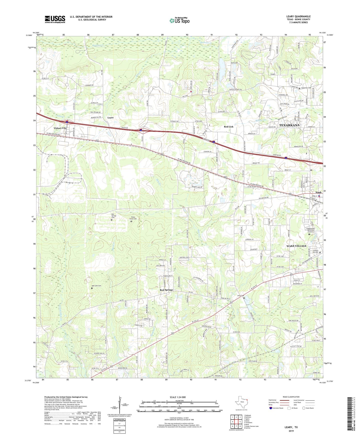
2022 topographic map quadrangle Leary in the state of Texas. Scale: 1:24000. Based on the newly updated USGS 7.5' US Topo map series, this map is in the following counties: Bowie. The map contains contour data, water features, and other items you are used to seeing on USGS maps, but also has updated roads and other features. This is the next generation of topographic maps. Printed on high-quality waterproof paper with UV fade-resistant inks.
Quads adjacent to this one:
West: Hooks
Northwest: Redbank
North: Barkman
Northeast: Ogden
East: Texarkana
Southeast: Domino
South: Wright Patman Lake
Southwest: Maud
This map covers the same area as the classic USGS quad with code o33094d2.
Contains the following named places: Bann Substation, Bob Lane Cemetery, C - 5 Red Lick Leary Volunteer Fire Station, Carpenter Cemetery, Chapelwood Memorial Gardens, City of Leary, City of Nash, City of Red Lick, City of Wake Village, Cross Pointe Baptist Church, Hartman, Hickory Hill Cemetery, Hickory Hill Church, Jones Creek, KCMC-AM (Texarkana), KLLI-FM (Hooks), KTXK-FM (Texarkana), Leary, Lone Star Army Ammunition Plant, Macedonia Church, Macedonia School, Nash, Nash City Hall, Nash Elementary School, Nash Police Department, Nash Post Office, Nash Volunteer Fire Department, Piney Grove Cemetery, Piney Grove Church, Price Cemetery, Rain Creek, Red Lick, Red Springs, Red Springs Cemetery, Redwater Lookout Tower, Victory City, ZIP Code: 75569