MyTopo
Humble City NE Texas US Topo Map
Couldn't load pickup availability
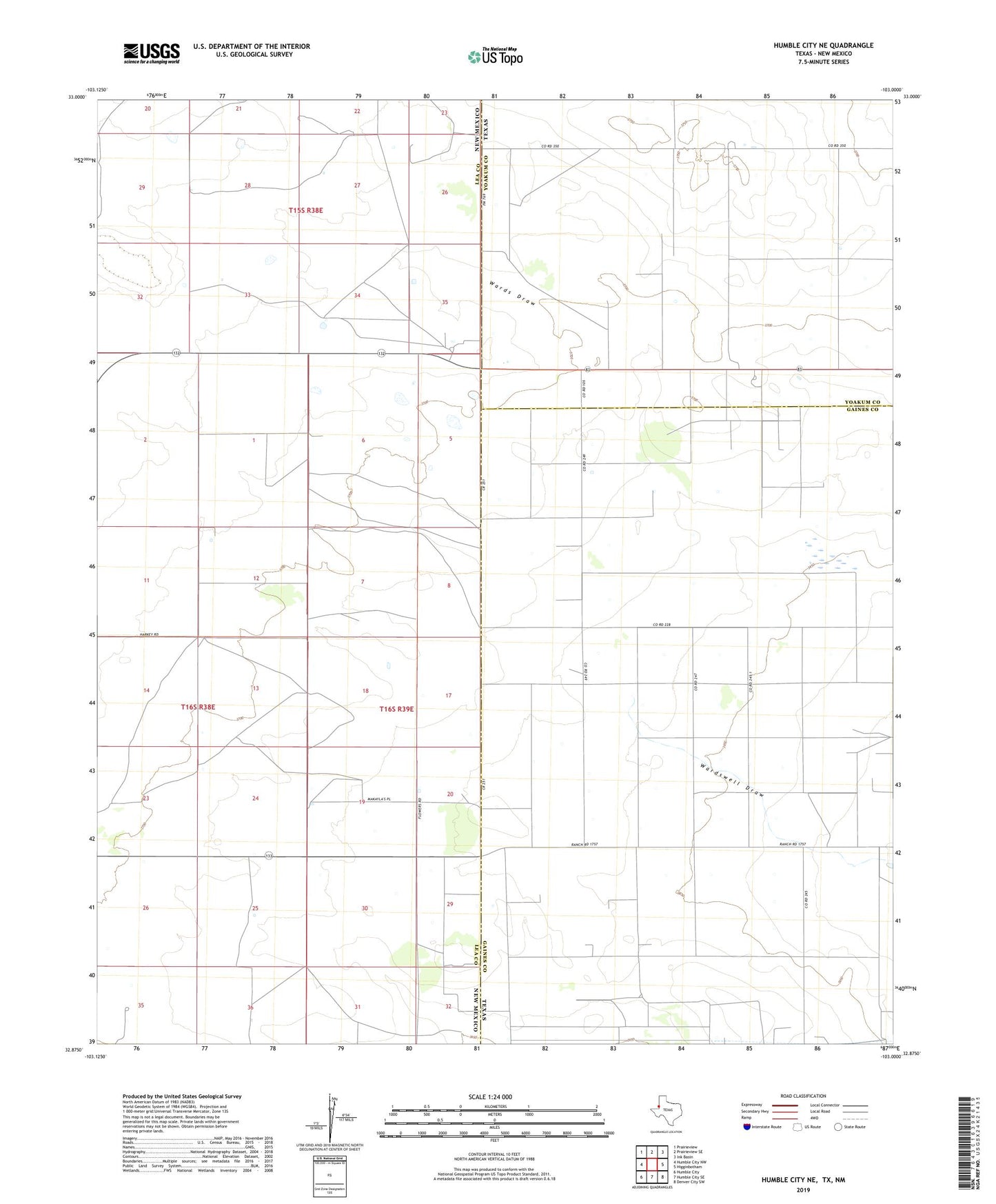
2022 topographic map quadrangle Humble City NE in the states of Texas, New Mexico. Scale: 1:24000. Based on the newly updated USGS 7.5' US Topo map series, this map is in the following counties: Gaines, Lea, Yoakum. The map contains contour data, water features, and other items you are used to seeing on USGS maps, but also has updated roads and other features. This is the next generation of topographic maps. Printed on high-quality waterproof paper with UV fade-resistant inks.
Quads adjacent to this one:
West: Humble City NW
Northwest: Prairieview
Northeast: Ink Basin
East: Higginbotham
Southeast: Denver City SW
South: Humble City SE
Southwest: Humble City
This map covers the same area as the classic USGS quad with code o32103h1.
Contains the following named places: 10155 Water Well, 10156 Water Well, 10196 Water Well, 10197 Water Well, 10198 Water Well, 10204 Water Well, 10205 Water Well, 10206 Water Well, Iron Windmill, Texpac Oil Field, Waits Ranch, West Windmill