MyTopo
Hurstown Texas US Topo Map
Couldn't load pickup availability
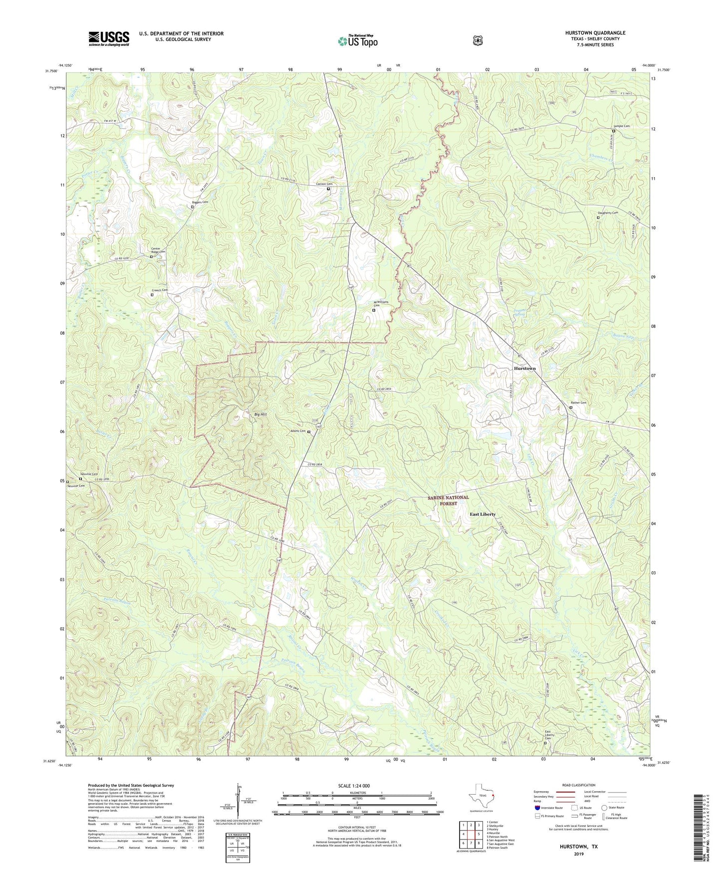
2019 topographic map quadrangle Hurstown in the state of Texas. Scale: 1:24000. Based on the newly updated USGS 7.5' US Topo map series, this map is in the following counties: Shelby. The map contains contour data, water features, and other items you are used to seeing on USGS maps, but also has updated roads and other features. This is the next generation of topographic maps. Printed on high-quality waterproof paper with UV fade-resistant inks.
Quads adjacent to this one:
West: Neuville
Northwest: Center
North: Shelbyville
Northeast: Huxley
East: Patroon North
Southeast: Patroon South
South: San Augustine East
Southwest: San Augustine West
Contains the following named places: Adams Cemetery, Big Hill, Biggers Cemetery, Biggers Creek, Butler Creek, Cannon Cemetery, Center Ridge Cemetery, Creech Cemetery, Crooked Creek, Daugherty Cemetery, Davis Ranch, Doggett Spring, East Liberty, East Liberty Cemetery, East Liberty Church, East Liberty School, Ephesus Church, Grubb Creek, Hurstown, McClelland, McWilliams Cemetery, Neuville Cemetery, Neuville School, Neuvine Cemetery, Palestine Church, Rascal Creek, Rather Cemetery, Sample Cemetery, Sandy Branch, Todd Springs Church, Wooten Creek