MyTopo
Patroon North Texas US Topo Map
Couldn't load pickup availability
Also explore the Patroon North Forest Service Topo of this same quad for updated USFS data
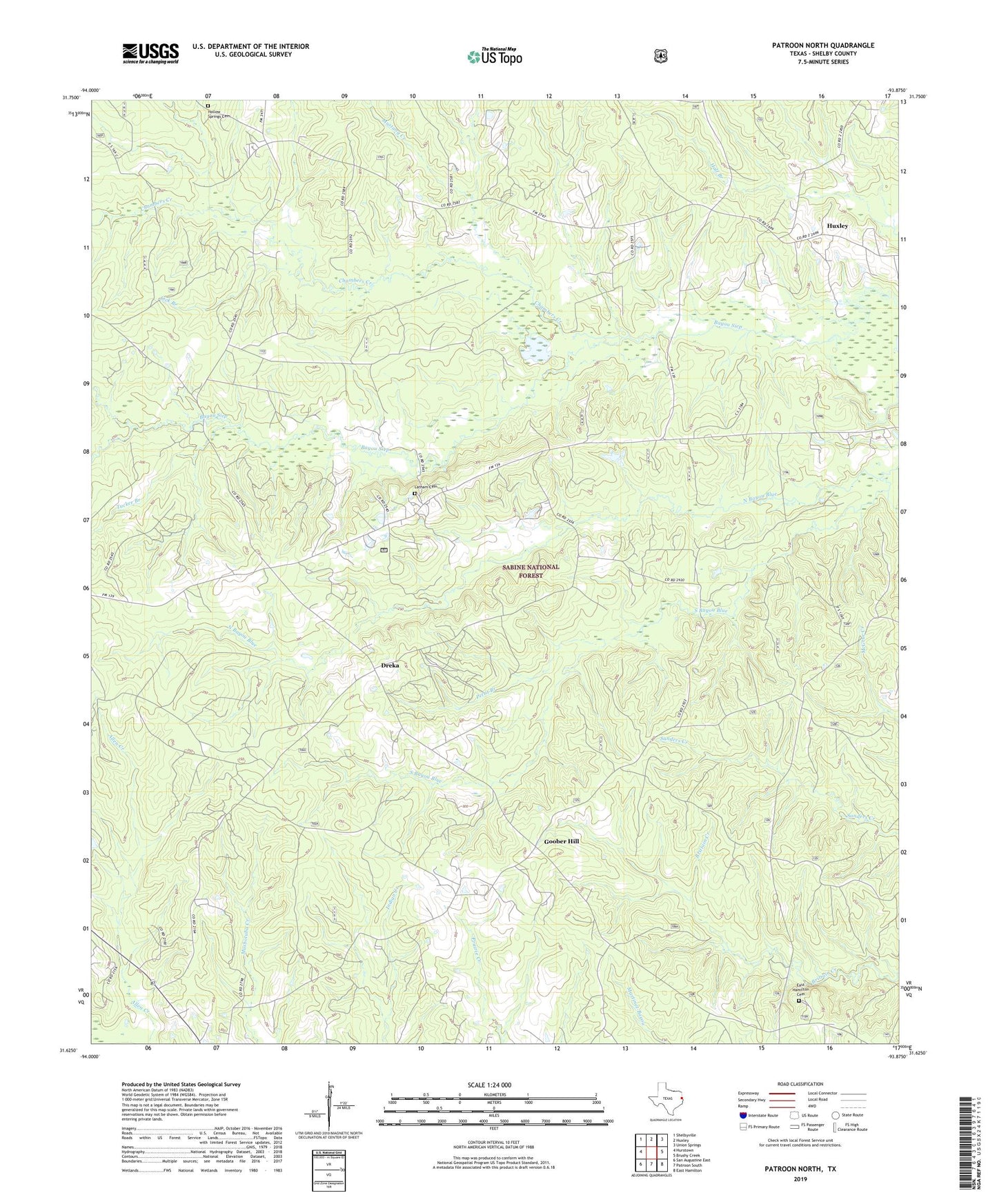
2022 topographic map quadrangle Patroon North in the state of Texas. Scale: 1:24000. Based on the newly updated USGS 7.5' US Topo map series, this map is in the following counties: Shelby. The map contains contour data, water features, and other items you are used to seeing on USGS maps, but also has updated roads and other features. This is the next generation of topographic maps. Printed on high-quality waterproof paper with UV fade-resistant inks.
Quads adjacent to this one:
West: Hurstown
Northwest: Shelbyville
North: Huxley
Northeast: Union Springs
East: Brushy Creek
Southeast: East Hamilton
South: Patroon South
Southwest: San Augustine East
This map covers the same area as the classic USGS quad with code o31093f8.
Contains the following named places: Bayou Siep, Chambers Creek, Dreka, Dreka Work Center, Dry Fork, East Hamilton Cemetery, Goober Hill, Holly Springs Cemetery, Jordans Store, Latham Cemetery, Lick Branch, Lone Star Church, Mustang Creek, New Harmon Church, New Harmony, North Bayou Blue, Pettit Branch, Ragtown, Sabine National Forest Trail, Shelbyville Division, South Bayou Blue, Strong School, Triumph Church, Tucker Branch, Welchs Store, West Hamilton, West Hamilton Church, ZIP Code: 75973