MyTopo
Hyman Texas US Topo Map
Couldn't load pickup availability
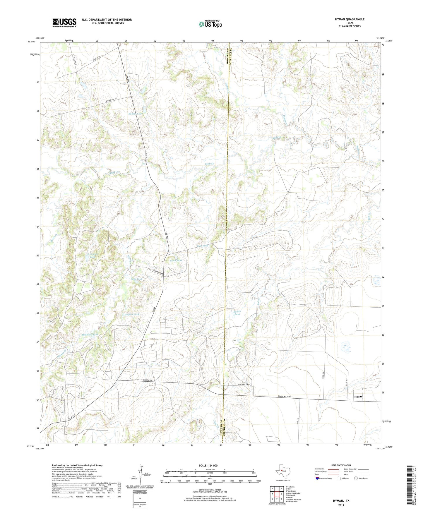
2019 topographic map quadrangle Hyman in the state of Texas. Scale: 1:24000. Based on the newly updated USGS 7.5' US Topo map series, this map is in the following counties: Howard, Mitchell. The map contains contour data, water features, and other items you are used to seeing on USGS maps, but also has updated roads and other features. This is the next generation of topographic maps. Printed on high-quality waterproof paper with UV fade-resistant inks.
Quads adjacent to this one:
West: Moss Creek Lake
Northwest: Coahoma
North: Iatan
Northeast: Westbrook
East: Hyman NE
Southeast: Buffalo Draw
South: Hayrick Mountain
Southwest: Forsan
Contains the following named places: Arrington Tank, Boyd Tank, Bull Creek Tank, Devils Creek, Dobson Creek, Dugout Creek, East Tank, Hayrick Tank, Hyman, Hyman Cemetery, Hyman Scott Oil Field, Magnolia Tank, Rankin Lake, Rankin Lake Dam, Scout Tank, Snyder Oil Field