MyTopo
Indian Mesa NE Texas US Topo Map
Couldn't load pickup availability
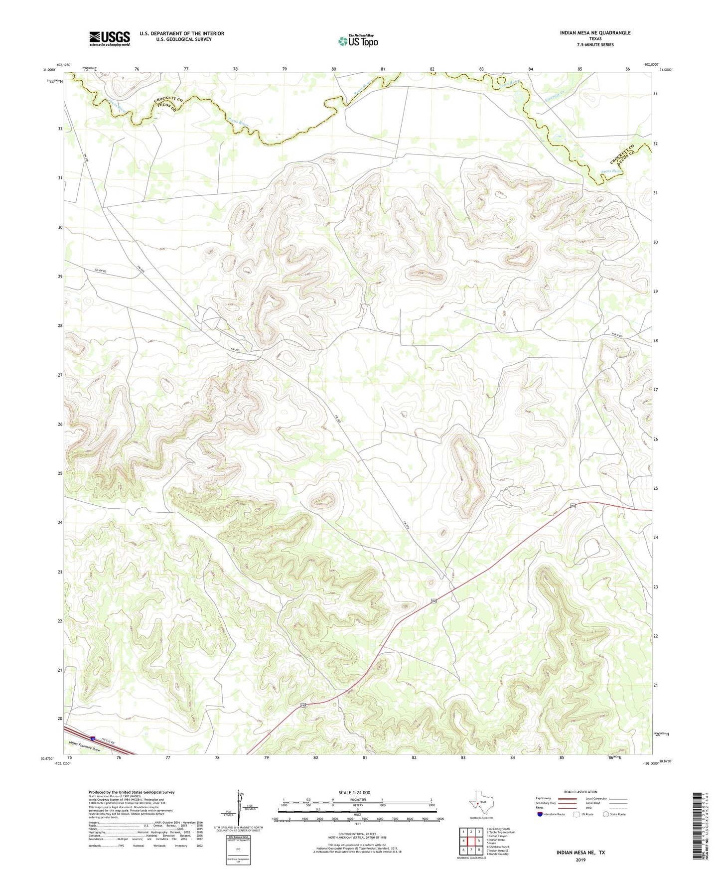
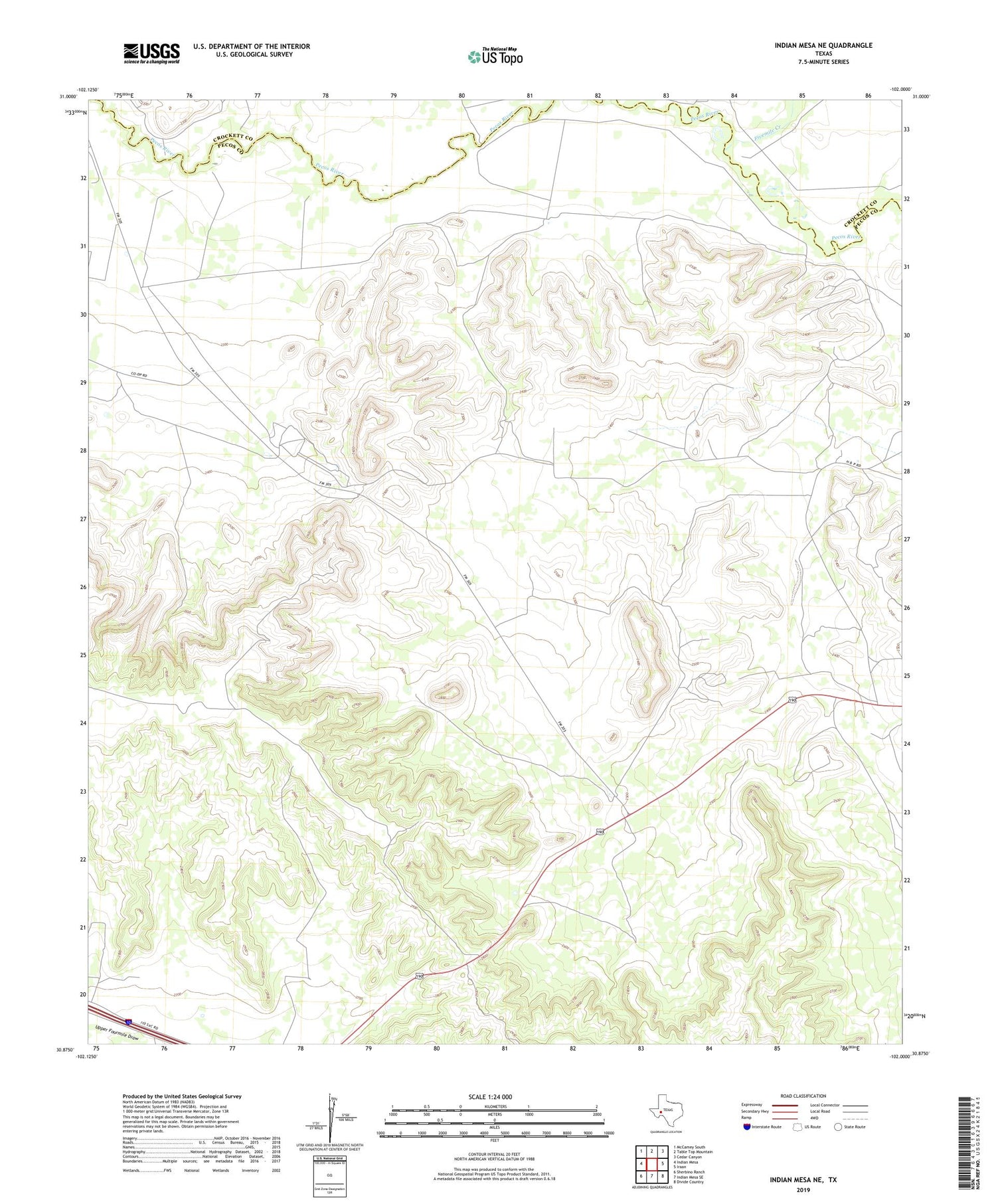
2019 topographic map quadrangle Indian Mesa NE in the state of Texas. Scale: 1:24000. Based on the newly updated USGS 7.5' US Topo map series, this map is in the following counties: Pecos, Crockett. The map contains contour data, water features, and other items you are used to seeing on USGS maps, but also has updated roads and other features. This is the next generation of topographic maps. Printed on high-quality waterproof paper with UV fade-resistant inks.
Quads adjacent to this one:
West: Indian Mesa
Northwest: McCamey South
North: Table Top Mountain
Northeast: Cedar Canyon
East: Iraan
Southeast: Divide Country
South: Indian Mesa SE
Southwest: Sherbino Ranch
Contains the following named places: Fivemile Creek, Iraan Museum, Toborg Oil Field, Wilson Ranch