MyTopo
Cedar Canyon Texas US Topo Map
Couldn't load pickup availability
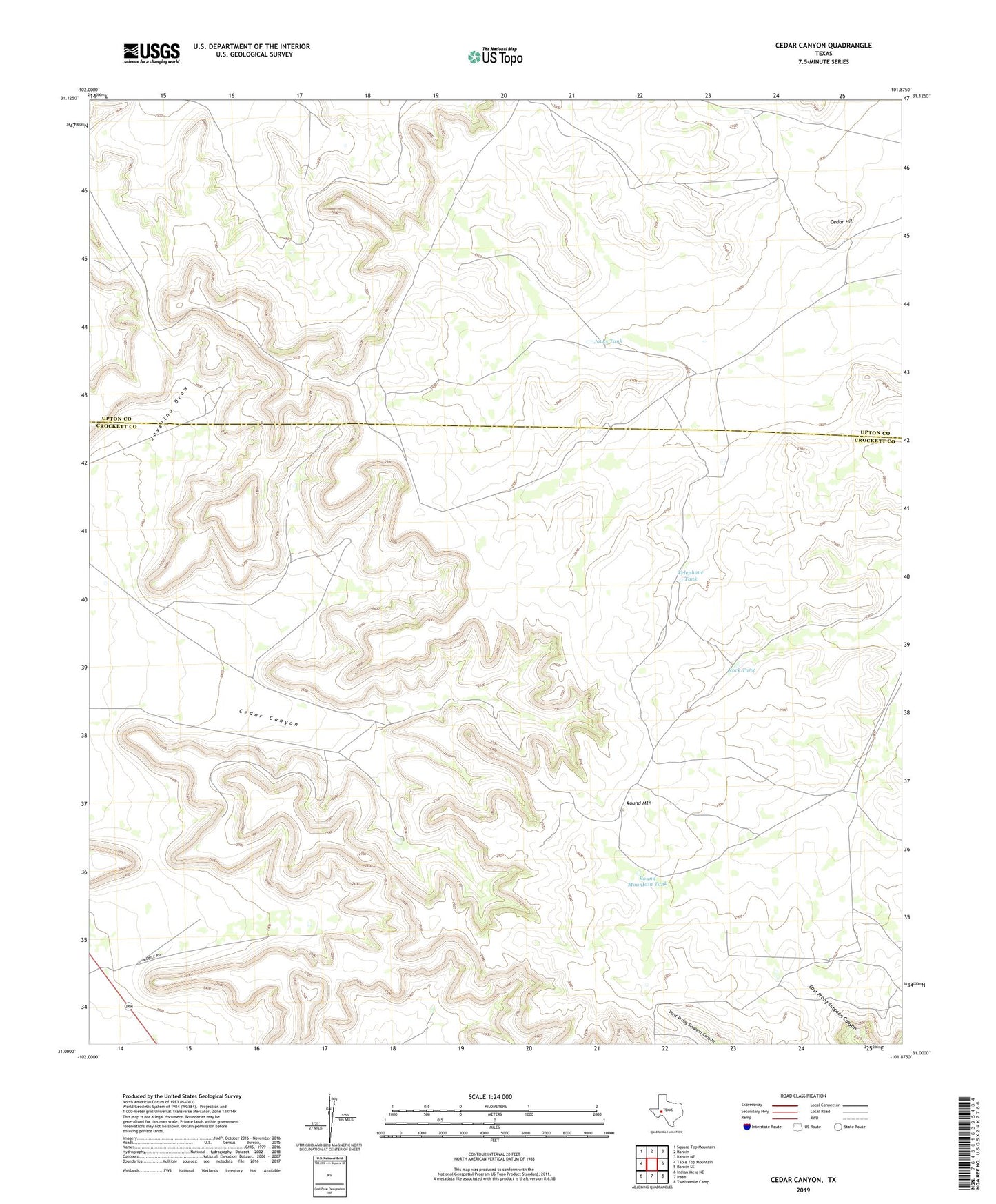
2022 topographic map quadrangle Cedar Canyon in the state of Texas. Scale: 1:24000. Based on the newly updated USGS 7.5' US Topo map series, this map is in the following counties: Crockett, Upton. The map contains contour data, water features, and other items you are used to seeing on USGS maps, but also has updated roads and other features. This is the next generation of topographic maps. Printed on high-quality waterproof paper with UV fade-resistant inks.
Quads adjacent to this one:
West: Table Top Mountain
Northwest: Square Top Mountain
North: Rankin
Northeast: Rankin NE
East: Rankin SE
Southeast: Twelvemile Camp
South: Iraan
Southwest: Indian Mesa NE
This map covers the same area as the classic USGS quad with code o31101a8.
Contains the following named places: Carter Windmill, Cedar Canyon, Cedar Canyon Windmill, Cedar Hill, Jacks Tank, Javelina Windmill, Munro Windmill, Oil Well Windmill, Point Windmill, Red Tower Windmill, Rock Tank, Round Mountain, Round Mountain Tank, Telephone Tank, Telephone Windmill, Twenty-Five Foot Windmill, West Windmill