MyTopo
Iola Texas US Topo Map
Couldn't load pickup availability
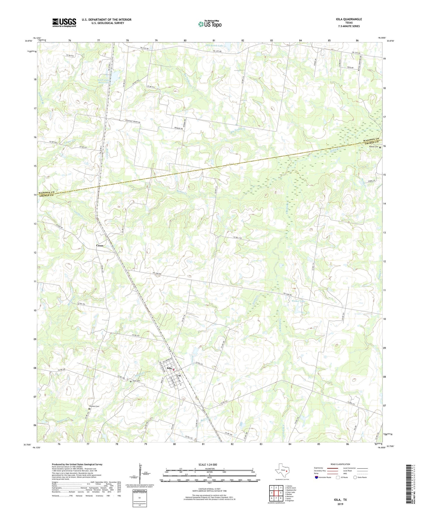
2019 topographic map quadrangle Iola in the state of Texas. Scale: 1:24000. Based on the newly updated USGS 7.5' US Topo map series, this map is in the following counties: Grimes, Madison. The map contains contour data, water features, and other items you are used to seeing on USGS maps, but also has updated roads and other features. This is the next generation of topographic maps. Printed on high-quality waterproof paper with UV fade-resistant inks.
Quads adjacent to this one:
West: Clear Lake
Northwest: Canary
North: North Zulch
Northeast: Madisonville
East: Bedias
Southeast: Singleton
South: Keith
Southwest: Reliance
Contains the following named places: Bethel Cemetery, Big Turkey Creek, City of Iola, Concord Church, Cross, Freewill Church, Howard Cemetery, Iola, Iola Post Office, Iola Volunteer Fire Department, KAGG-FM (Madisonville), LFD Ranch Lake, Neeley Creek, North Bedias Creek, Panky Creek, Pleasant Grove Church, Shiloh Church, South Zulch Reservoir, South Zulch Reservoir Dam, Walker Lake, Walker Lake Dam, Zion Cemetery