MyTopo
Bedias Texas US Topo Map
Couldn't load pickup availability
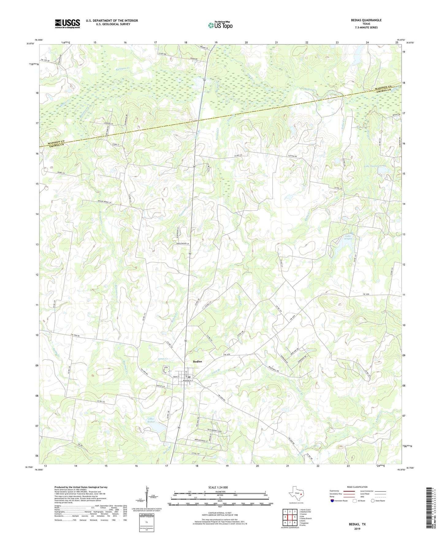
2022 topographic map quadrangle Bedias in the state of Texas. Scale: 1:24000. Based on the newly updated USGS 7.5' US Topo map series, this map is in the following counties: Grimes, Madison. The map contains contour data, water features, and other items you are used to seeing on USGS maps, but also has updated roads and other features. This is the next generation of topographic maps. Printed on high-quality waterproof paper with UV fade-resistant inks.
Quads adjacent to this one:
West: Iola
Northwest: North Zulch
North: Madisonville
Northeast: Connor
East: Steep Branch
Southeast: Loma
South: Singleton
Southwest: Keith
This map covers the same area as the classic USGS quad with code o30095g8.
Contains the following named places: Bedias, Bedias City Office, Bedias Creek, Bedias Post Office, Bishop Creek, Bowman Creek, Bullard Lake, Bullard Lake Dam, Cedar Creek, City of Bedias, Cotton, Iron Creek, Kickapoo Creek, Lake Bedias, Lake Bedias Dam, Lake Donna V, Lake Donna V Dam, Lake Wayne, Lake Wayne Dam, Lone Star Church, Mount Pleasant Church, Primitive Stone Church, Rocky Creek, Saint Joseph Emergency Medical Services, Simes Creek, Town Branch, Twisted Creek, Wren Branch