MyTopo
Canary Texas US Topo Map
Couldn't load pickup availability
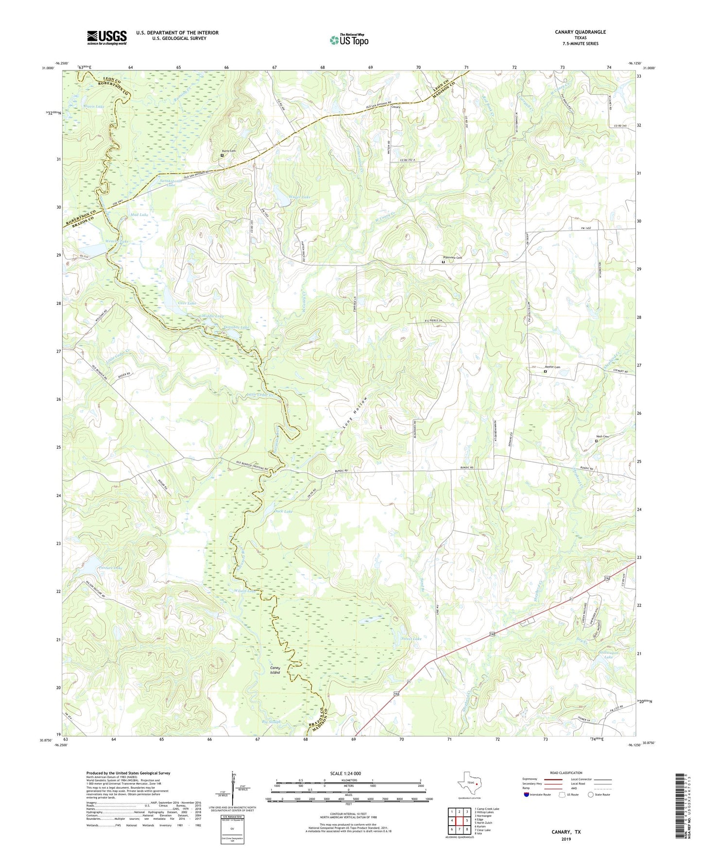
2022 topographic map quadrangle Canary in the state of Texas. Scale: 1:24000. Based on the newly updated USGS 7.5' US Topo map series, this map is in the following counties: Madison, Brazos, Leon, Robertson. The map contains contour data, water features, and other items you are used to seeing on USGS maps, but also has updated roads and other features. This is the next generation of topographic maps. Printed on high-quality waterproof paper with UV fade-resistant inks.
Quads adjacent to this one:
West: Edge
Northwest: Camp Creek Lake
North: Hilltop Lakes
Northeast: Normangee
East: North Zulch
Southeast: Iola
South: Clear Lake
Southwest: Kurten
This map covers the same area as the classic USGS quad with code o30096h2.
Contains the following named places: Big Slough, Bundy Crossing, Burns Cemetery, Canary, Caney Island, Carr Lake, Carryall Creek, Cottonwood Creek, Davis Lake, Donahoe Lake, Dry Creek, Duck Lake, Keefer Cemetery, Little Cedar Creek, Long Hollow, Manning Church, McDonald Creek, Middle Lake, Mud Lake, Nash Cemetery, Pasture Lake, Pasture Lake Dam, Plainview Cemetery, Red Bank Creek, Running Creek, San Antonio Lake, Sand Branch, Stillwagon Lake, Stillwagon Lake Dam, Sweet Lake, Wager Lake, Wager Lake Dam, Weaver Lake, Weaver Lake Dam, West Caney Creek, Wilson Lake, ZIP Code: 77872