
MyTopo
Ivan North Texas US Topo Map
Couldn't load pickup availability
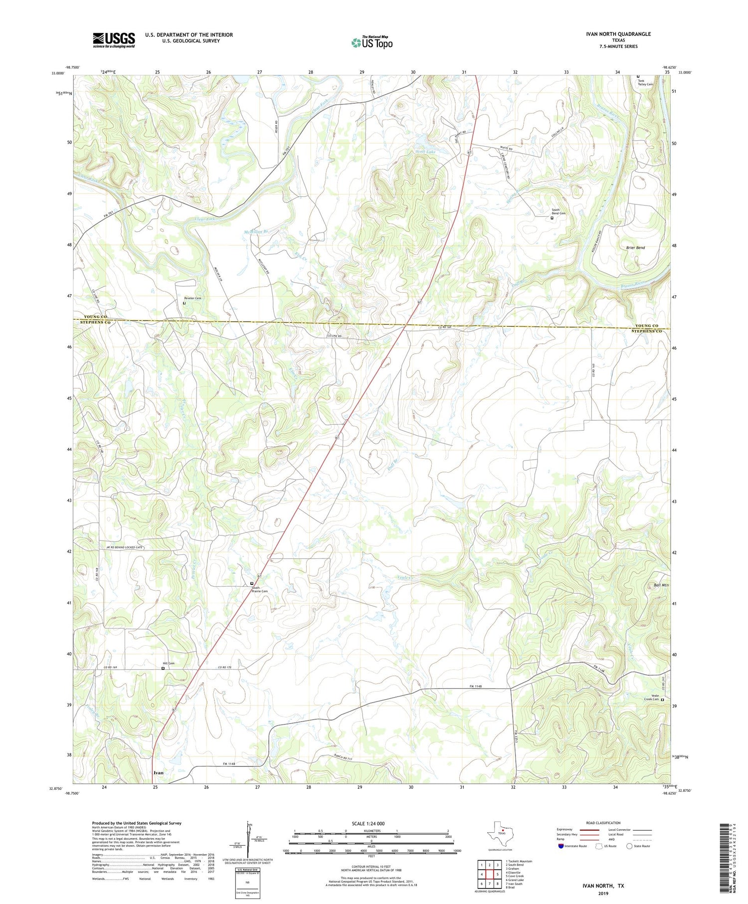
2019 topographic map quadrangle Ivan North in the state of Texas. Scale: 1:24000. Based on the newly updated USGS 7.5' US Topo map series, this map is in the following counties: Stephens, Young. The map contains contour data, water features, and other items you are used to seeing on USGS maps, but also has updated roads and other features. This is the next generation of topographic maps. Printed on high-quality waterproof paper with UV fade-resistant inks.
Quads adjacent to this one:
West: Eliasville
Northwest: Tackett Mountain
North: South Bend
Northeast: Graham
East: Cove Creek
Southeast: Brad
South: Ivan South
Southwest: Grand Lake
Contains the following named places: Ball Mountain, Brier Bend, Duff Branch, Elm Creek, Hill Cemetery, McMillan Branch, Peveler Cemetery, Peveler Creek, Scott Lake, Scott Lake Dam, South Bend Cemetery, South Prairie Cemetery, Spring Branch, Tonk Valley Cemetery, Veale Creek Cemetery, ZIP Code: 76481


