MyTopo
Brad Texas US Topo Map
Couldn't load pickup availability
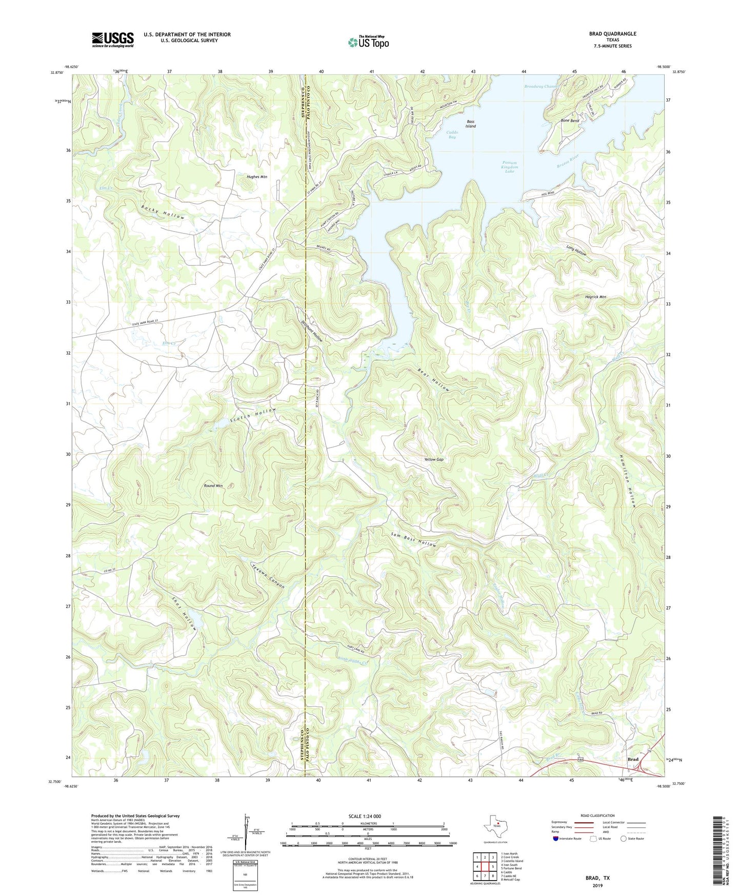
2022 topographic map quadrangle Brad in the state of Texas. Scale: 1:24000. Based on the newly updated USGS 7.5' US Topo map series, this map is in the following counties: Palo Pinto, Stephens. The map contains contour data, water features, and other items you are used to seeing on USGS maps, but also has updated roads and other features. This is the next generation of topographic maps. Printed on high-quality waterproof paper with UV fade-resistant inks.
Quads adjacent to this one:
West: Ivan South
Northwest: Ivan North
North: Cove Creek
Northeast: Costello Island
East: Fortune Bend
Southeast: Metcalf Gap
South: Caddo NE
Southwest: Caddo
This map covers the same area as the classic USGS quad with code o32098g5.
Contains the following named places: Bass Island, Bear Hollow, Bee Creek, Bone Bend, Brad, Brad Branch, Caddo Bay, Caddo Creek, Cedar Springs Church, Dillihunt Hollow, Elm Creek, Hamilton Hollow, Hayrick Mountain, Hughes Mountain, Iles Oil Field, Little Caddo Creek, Long Hollow, Petes Pride Lake, Petes Pride Lake Dam, Pitzer Lake, Pitzer Lake Dam, Possum Kingdom Lake, Possum Kingdom State Park, Possum Kingdom State Park Trail, Rocky Hollow, Round Mountain, Sam Bass Hollow, Scotch Hollow, Shot Hollow, Taylor Hollow, Texawa Canyon, Yellow Gap