
MyTopo
Ivan South Texas US Topo Map
Couldn't load pickup availability
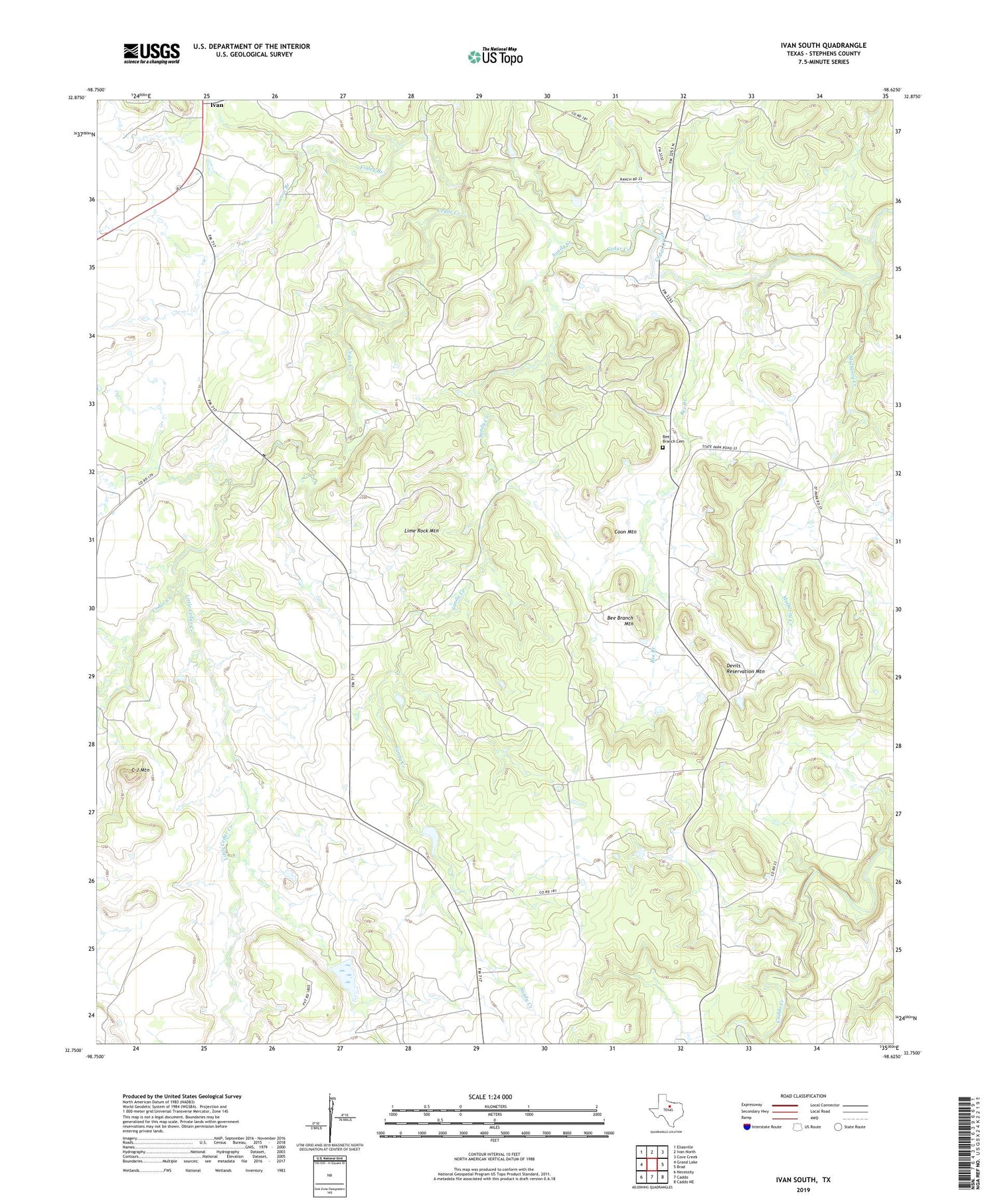
2019 topographic map quadrangle Ivan South in the state of Texas. Scale: 1:24000. Based on the newly updated USGS 7.5' US Topo map series, this map is in the following counties: Stephens. The map contains contour data, water features, and other items you are used to seeing on USGS maps, but also has updated roads and other features. This is the next generation of topographic maps. Printed on high-quality waterproof paper with UV fade-resistant inks.
Quads adjacent to this one:
West: Grand Lake
Northwest: Eliasville
North: Ivan North
Northeast: Cove Creek
East: Brad
Southeast: Caddo NE
South: Caddo
Southwest: Necessity
Contains the following named places: Bee Branch, Bee Branch Cemetery, Bee Branch Mountain, C J Mountain, Coon Mountain, Devils Reservation Mountain, Finley Branch, Ivan, Lime Rock Mountain, Little Cedar Creek, Monroe Veal Dam, Mulberry Creek, Norton Branch, Oak Grove Church, Sandy Creek, Stephens Company Water Company Lake Dam, Stephens Company Water Company Reservoir, Tullos Lake, ZIP Code: 76429


