MyTopo
Keechi Texas US Topo Map
Couldn't load pickup availability
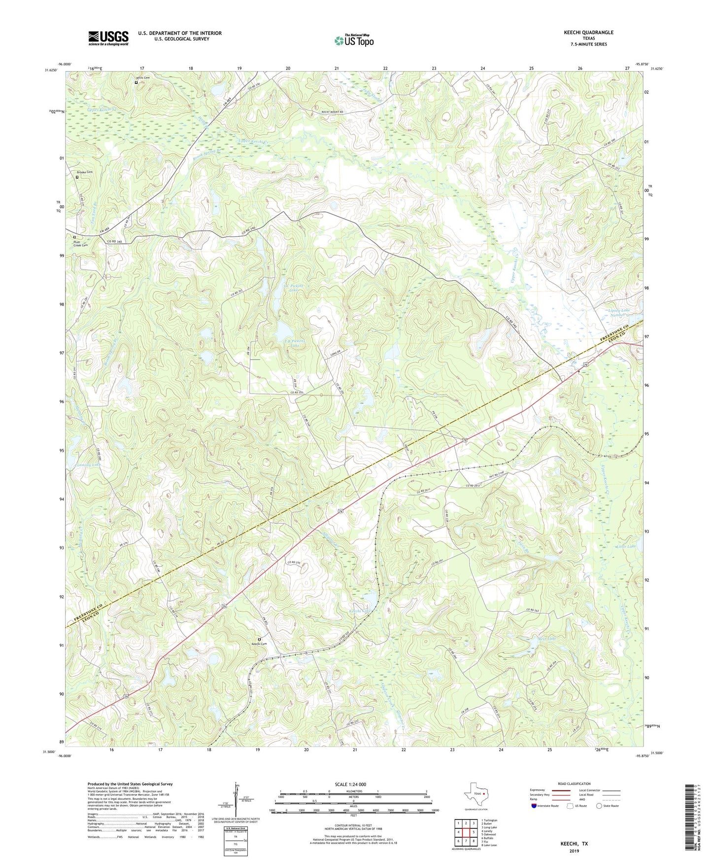
2019 topographic map quadrangle Keechi in the state of Texas. Scale: 1:24000. Based on the newly updated USGS 7.5' US Topo map series, this map is in the following counties: Freestone, Leon. The map contains contour data, water features, and other items you are used to seeing on USGS maps, but also has updated roads and other features. This is the next generation of topographic maps. Printed on high-quality waterproof paper with UV fade-resistant inks.
Quads adjacent to this one:
West: Lanely
Northwest: Turlington
North: Butler
Northeast: Long Lake
East: Oakwood
Southeast: Lake Leon
South: Flo
Southwest: Buffalo
Contains the following named places: Bess Lake, Bess Lake Dam, Brook Spring Branch, Brooke Cemetery, Brown Chapel, Connolly Lake, Connolly Lake Dam, Holly Branch, Jelly Slough, Keechi, Keechi Cemetery, Keechi Lake, Lipsey Lake Dam Number 2, Lipsey Lake Number 2, Little Lake Dam, Mount Zion Church, Oakwood Dome Oil Field, Plum Creek, Plum Creek Cemetery, Rocky Mount Church, S C Pickins Dam, S C Pickins Lake, T B Pickens Dam, T B Pickens Lake, Tan Yard Branch, Trahin School, Twin Branch, Willis Cemetery