MyTopo
Kenedy Texas US Topo Map
Couldn't load pickup availability
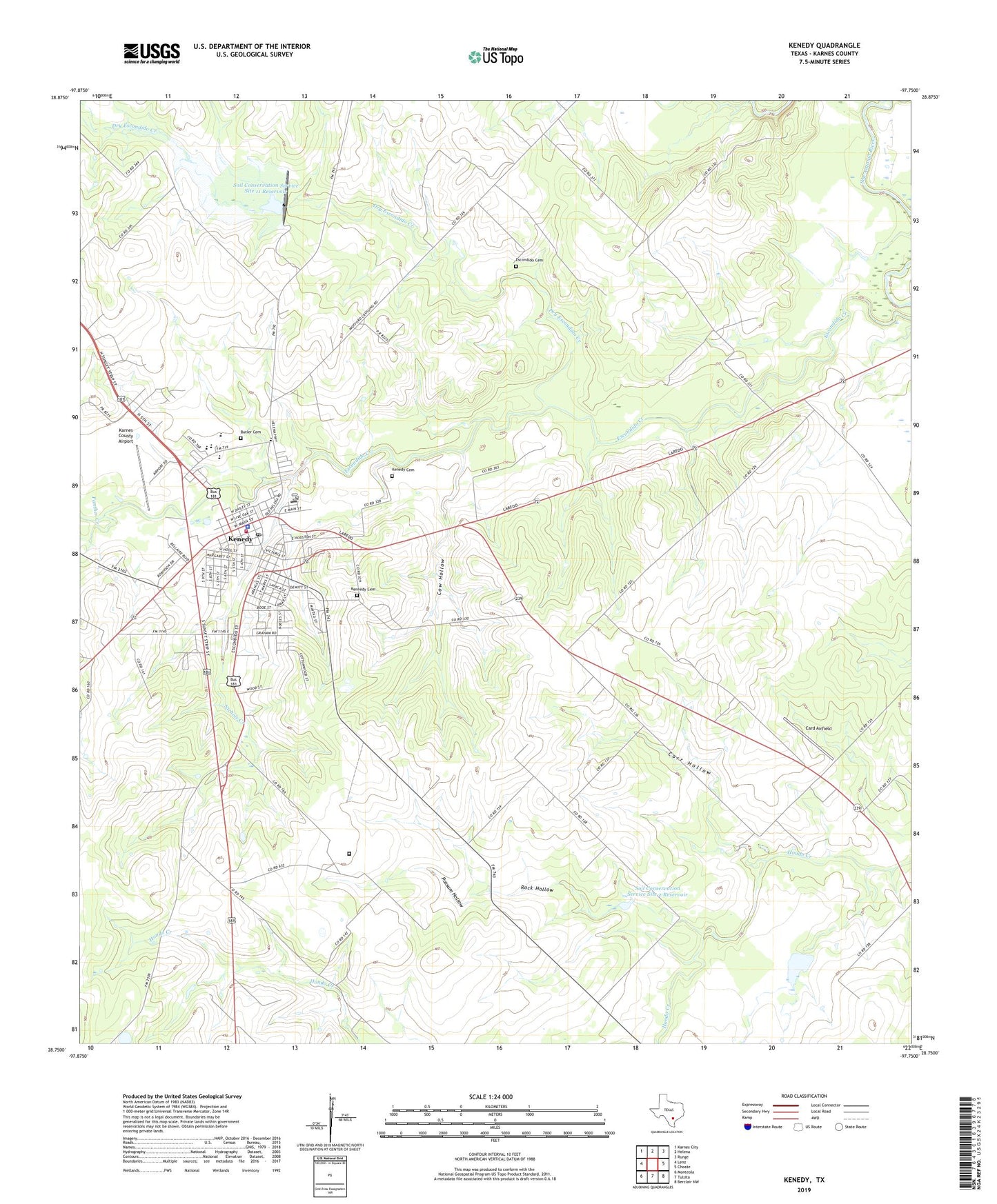
2019 topographic map quadrangle Kenedy in the state of Texas. Scale: 1:24000. Based on the newly updated USGS 7.5' US Topo map series, this map is in the following counties: Karnes. The map contains contour data, water features, and other items you are used to seeing on USGS maps, but also has updated roads and other features. This is the next generation of topographic maps. Printed on high-quality waterproof paper with UV fade-resistant inks.
Quads adjacent to this one:
West: Lenz
Northwest: Karnes City
North: Helena
Northeast: Runge
East: Choate
Southeast: Berclair NW
South: Tulsita
Southwest: Monteola
Contains the following named places: Ball Park, Butler Cemetery, Card Airfield, Carr Hollow, City of Kenedy, Community Bible Church, Cow Hollow, Dam Number 11, Dry Escondido Creek, Escondido Cemetery, First Mexican Baptist Church, Good Shephard Lutheran Church, Hondo Creek Oil Field, Karnes County Academy, Karnes County Airport, Karnes County Emergency Medical Service Ambulance, Kenedy, Kenedy Cemetery, Kenedy Church of Christ, Kenedy Division, Kenedy Elementary School, Kenedy High School, Kenedy Middle School, Kenedy Municipal Building, Kenedy Museum, Kenedy Police Department, Kenedy Post Office, Kenedy Volunteer Fire Department, Kennedy Cemetery, KTNR-FM (Kenedy), Nichols Creek, Panther Creek, Possum Hollow, Rialto Theater, Rock Hollow, Saint Matthews Episcopal Church, Soil Conservation Service Site 11 Dam, Soil Conservation Service Site 11 Reservoir, Soil Conservation Service Site 2 Dam, Soil Conservation Service Site 2 Reservoir, Soil Conservation Service Site 3 Dam, Soil Conservation Service Site 3 Reservoir, Texas Department of Criminal Justice John B Connally Unit, Unified Pentecostal Church