MyTopo
Karnes City Texas US Topo Map
Couldn't load pickup availability
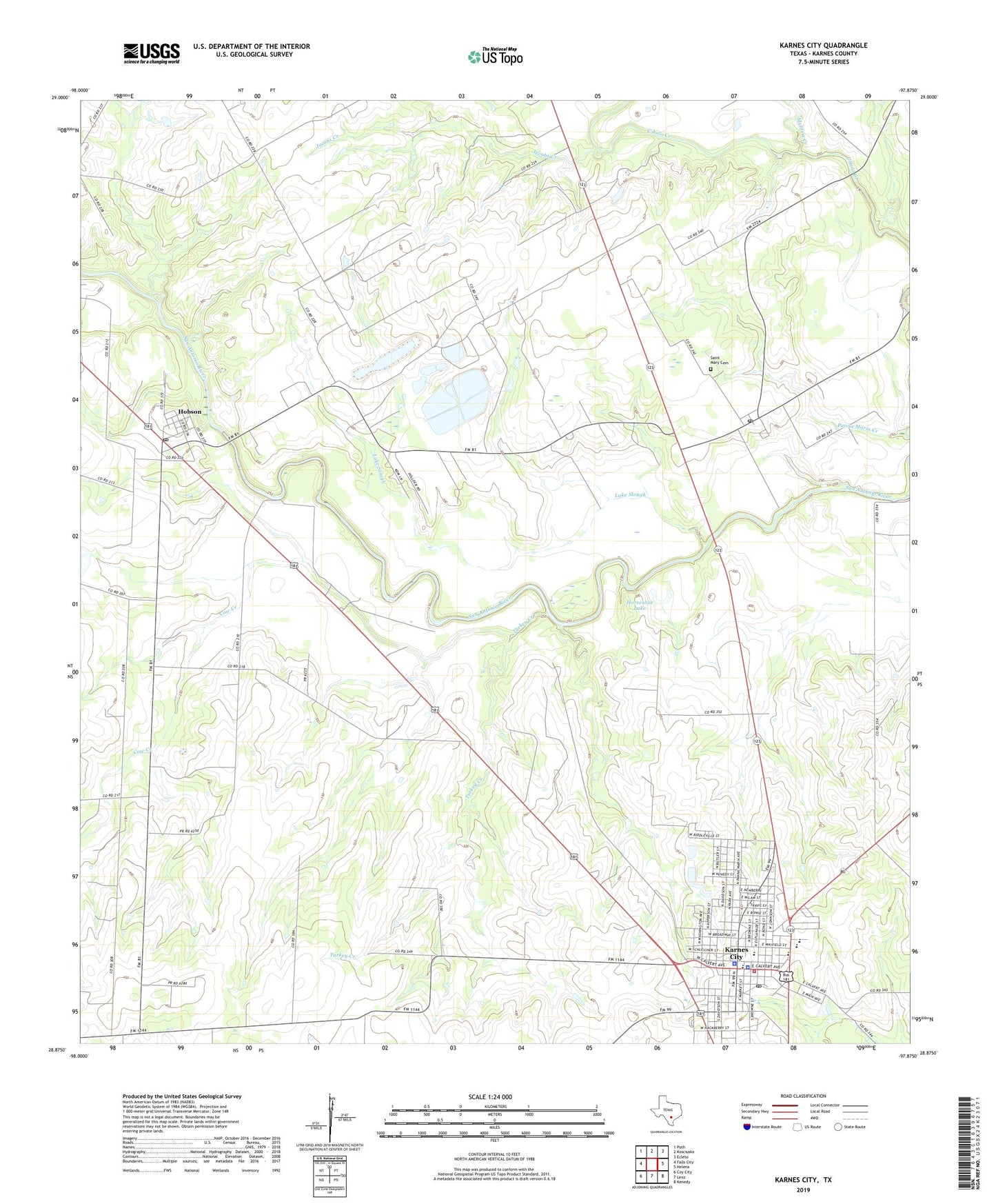
2022 topographic map quadrangle Karnes City in the state of Texas. Scale: 1:24000. Based on the newly updated USGS 7.5' US Topo map series, this map is in the following counties: Karnes. The map contains contour data, water features, and other items you are used to seeing on USGS maps, but also has updated roads and other features. This is the next generation of topographic maps. Printed on high-quality waterproof paper with UV fade-resistant inks.
Quads adjacent to this one:
West: Falls City
Northwest: Poth
North: Kosciusko
Northeast: Ecleto
East: Helena
Southeast: Kenedy
South: Lenz
Southwest: Coy City
This map covers the same area as the classic USGS quad with code o28097h8.
Contains the following named places: City of Karnes City, Cow Creek, First Baptist Church, First Presbyterian Church, Highland Park, Hobson, Hobson Post Office, Horseshoe Lake, Jacobs Creek, Karnes City, Karnes City - City Hall, Karnes City High School, Karnes City Junior High School, Karnes City Police Department, Karnes City Post Office, Karnes City Refinery, Karnes City Volunteer Fire Department, Karnes County Courthouse, Karnes County Jail, Karnes County Sheriff's Department, Karnes County Sheriff's Office, Lake Slough, Mayo, Mulifest Creek, Panna Maria, Panna Maria Historic District, Panna Maria Post Office, Roger E Sides Elementary School, Saint Cornelius Catholic Church, Saint Mary Cemetery, Saint Pauls Lutheran Church, Turkey Creek, ZIP Codes: 78117, 78144