MyTopo
Kilgore NW Texas US Topo Map
Couldn't load pickup availability
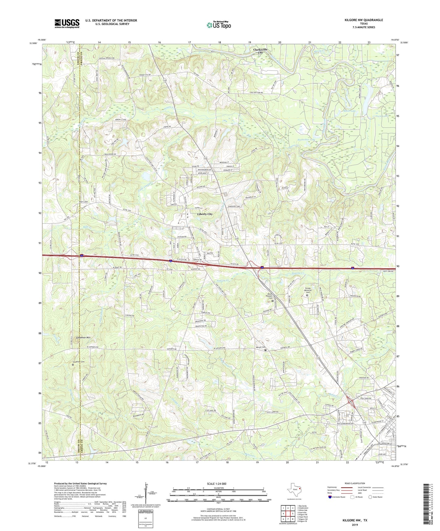
2019 topographic map quadrangle Kilgore NW in the state of Texas. Scale: 1:24000. Based on the newly updated USGS 7.5' US Topo map series, this map is in the following counties: Gregg, Smith. The map contains contour data, water features, and other items you are used to seeing on USGS maps, but also has updated roads and other features. This is the next generation of topographic maps. Printed on high-quality waterproof paper with UV fade-resistant inks.
Quads adjacent to this one:
West: Starrville
Northwest: Big Sandy
North: Gladewater
Northeast: White Oak
East: Kilgore NE
Southeast: Kilgore SE
South: Kilgore SW
Southwest: Hope Pond
Contains the following named places: Belle Creek, Bethel Baptist Church, Big Caney Creek, Black Lake, C B Dansby School, Deadman Curve, Elder School, First Pentecostal Church, Goodman Cemetery, Goodman Mountain, Gourdneck Branch, Helton Creek, Horseshoe Lake, Joy Church, Kilgore, Kilgore Baptist Church, Liberty City, Liberty City Census Designated Place, Liberty City Division, Lincoln Springs Church, Little Caney Creek, Merrills Lake, Moody Creek, Moriah Cemetery, Mount Pleasant Cemetery, North Chapel Church, North Chapel School, Prairie Creek, Rock Springs School, Rocky Creek, Sabine Elementary School, Sabine High School, Sabine School, Saints Chapel Church, Sandot Creek, Strong Memorial Cemetery, Twin Lakes, West View Church of Christ