MyTopo
Big Sandy Texas US Topo Map
Couldn't load pickup availability
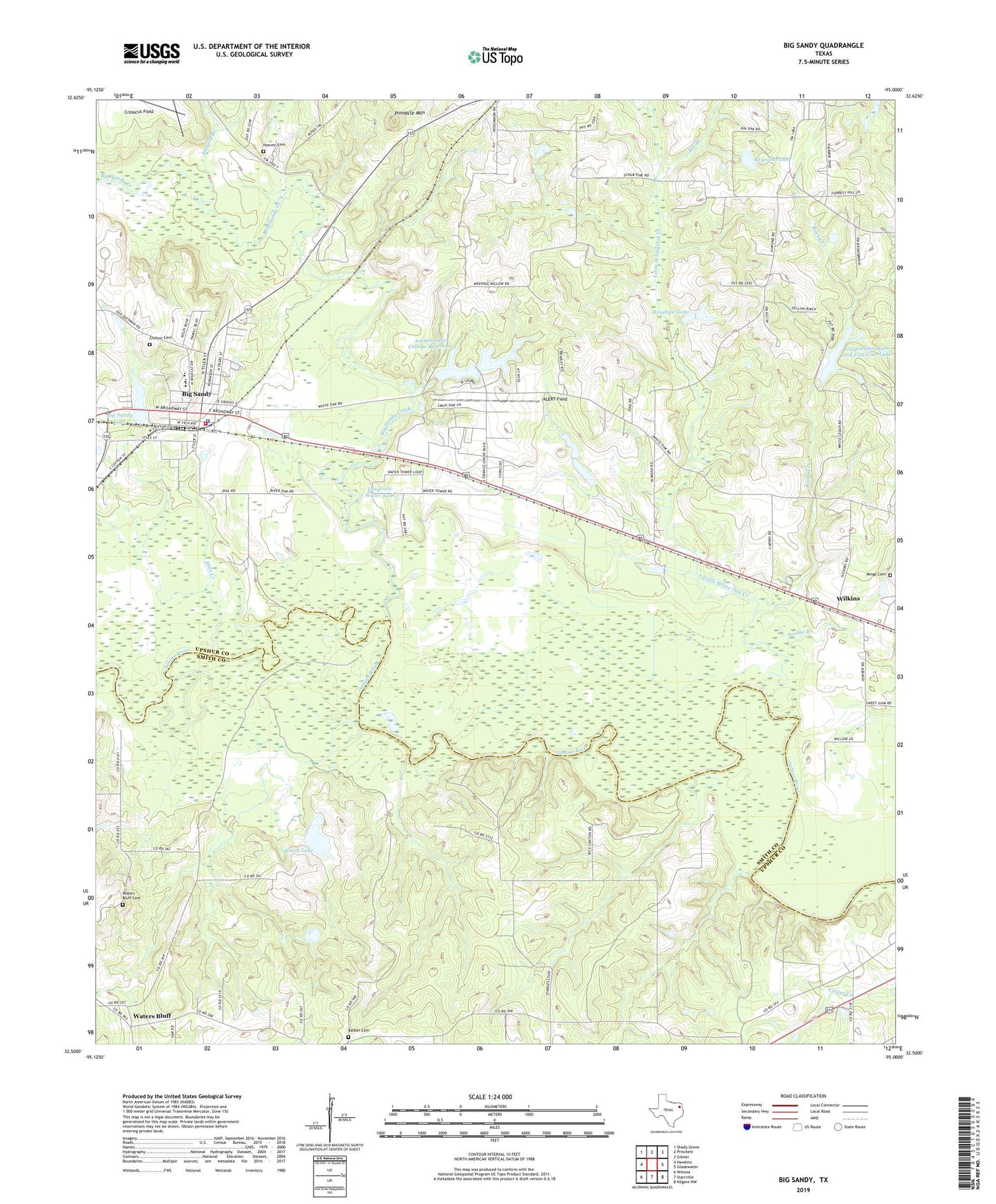
2022 topographic map quadrangle Big Sandy in the state of Texas. Scale: 1:24000. Based on the newly updated USGS 7.5' US Topo map series, this map is in the following counties: Upshur, Smith. The map contains contour data, water features, and other items you are used to seeing on USGS maps, but also has updated roads and other features. This is the next generation of topographic maps. Printed on high-quality waterproof paper with UV fade-resistant inks.
Quads adjacent to this one:
West: Hawkins
Northwest: Shady Grove
North: Pritchett
Northeast: Gilmer
East: Gladewater
Southeast: Kilgore NW
South: Starrville
Southwest: Winona
This map covers the same area as the classic USGS quad with code o32095e1.
Contains the following named places: ALERT Field, Ambassador College Reservoir, Ambassador College Reservoir Dam, Ballard Branch, Barber Cemetery, Bee Branch, Bethel Church, Big Sandy, Big Sandy City Hall, Big Sandy Creek, Big Sandy Dam, Big Sandy Division, Big Sandy Fire Department, Big Sandy Lake, Big Sandy Police Department, Big Sandy Post Office, Camp Natowa, Center Point, Chilton Cemetery, Church of Christ, Deer Park Public Library, Evelyn Meador Branch Library, Excelsior School, Gladewater Hunt and Fish Club Dam, Gladewater Hunt and Fish Club Lake, Gladewater Memorial Park, Green Lake, Green Lake Dam, Hills Creek, Hoover Cemetery, Little White Oak Creek, Locust Grove Church, Longview Big Sandy Dam, Longview Big Sandy Reservoir, Longview Water Tank, Mings Cemetery, New Hope Church, Perdue Branch, Pinnacle Mountain, Powell Chapel, Renshaw Lake, Renshaw Lake Dam, Reynolds Lake, Reynolds Lake Dam, Rocky Creek, Seventh Day Adventist Camp, Starville Church, Town of Big Sandy, Union Grove Church, United Church of God, Waters Bluff, Waters Bluff Cemetery, Wilkins