MyTopo
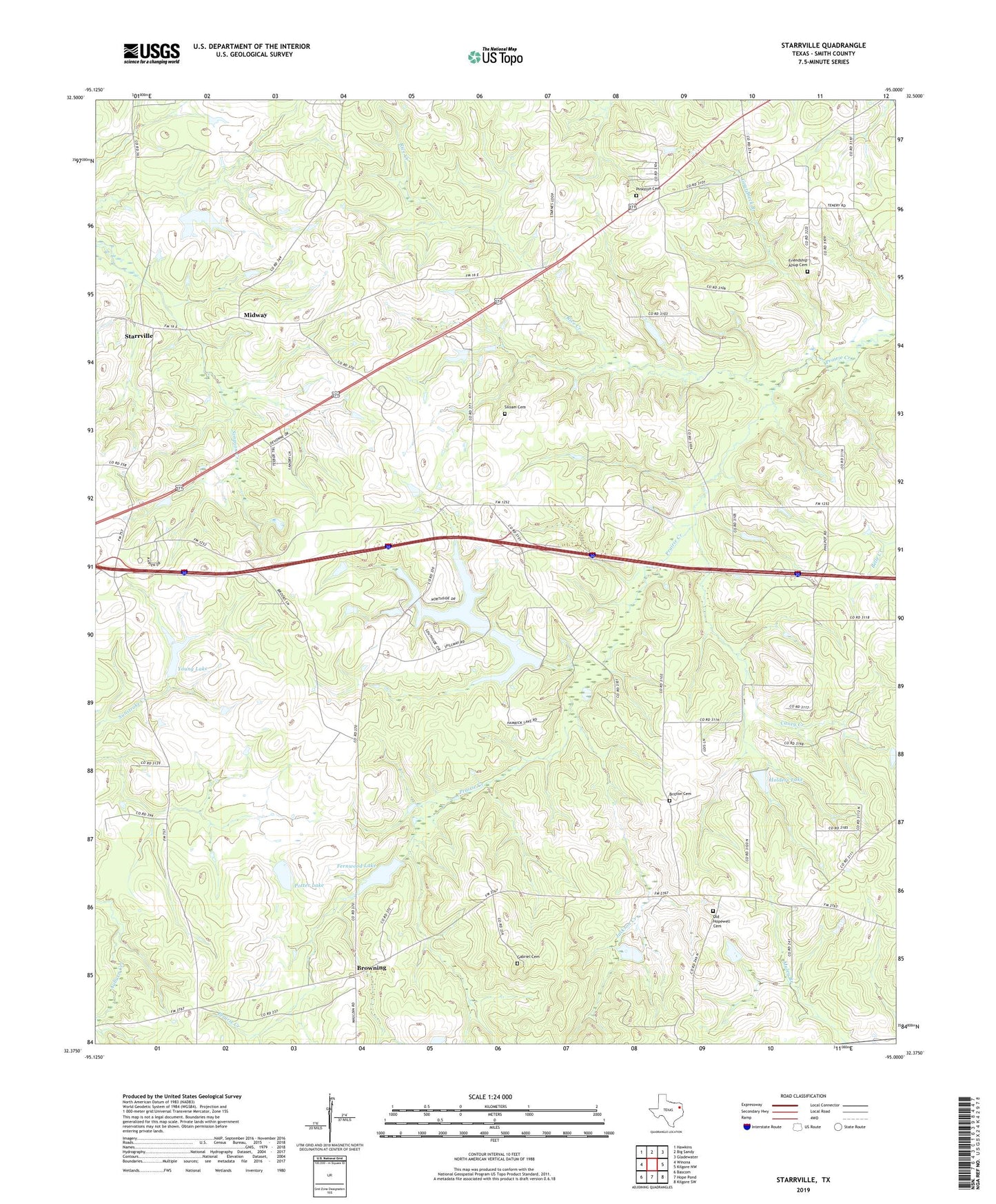
Starrville Texas US Topo Map
Couldn't load pickup availability
2022 topographic map quadrangle Starrville in the state of Texas. Scale: 1:24000. Based on the newly updated USGS 7.5' US Topo map series, this map is in the following counties: Smith. The map contains contour data, water features, and other items you are used to seeing on USGS maps, but also has updated roads and other features. This is the next generation of topographic maps. Printed on high-quality waterproof paper with UV fade-resistant inks.
Quads adjacent to this one:
West: Winona
Northwest: Hawkins
North: Big Sandy
Northeast: Gladewater
East: Kilgore NW
Southeast: Kilgore SW
South: Hope Pond
Southwest: Bascom
This map covers the same area as the classic USGS quad with code o32095d1.
Contains the following named places: Alsup Cemetery, Britton Cemetery, Browning, Caney Creek, Corinth Church, County Line Church, Dunbar School, Fernwood Lake, Fernwood Lake Dam, Friendship, Gabriel Cemetery, Gees Memorial Church, Hamrick Dam, Hamrick Lake, Holders Lake, Holders Lake Dam, Howell Club Lake, Howell Club Lake Dam, Jackson Creek, KTHP-TV (Longview), Midway, Mount Eara Church, Mount Zion Church, New Home Baptist Church, New Mountain Church, Oakdale Church, Old Hopewell Cemetery, Pinkston Cemetery, Potter Lake, Potter Lake Dam, Rice Creek, Siloam Cemetery, Siloam Church, Starrville, Starrville Church, Trap Travelstead Field, Warren Church, Wright Mountain Oil Field, Young Lake, Young Lake Dam, ZIP Code: 75792