MyTopo
Kingsbury Texas US Topo Map
Couldn't load pickup availability
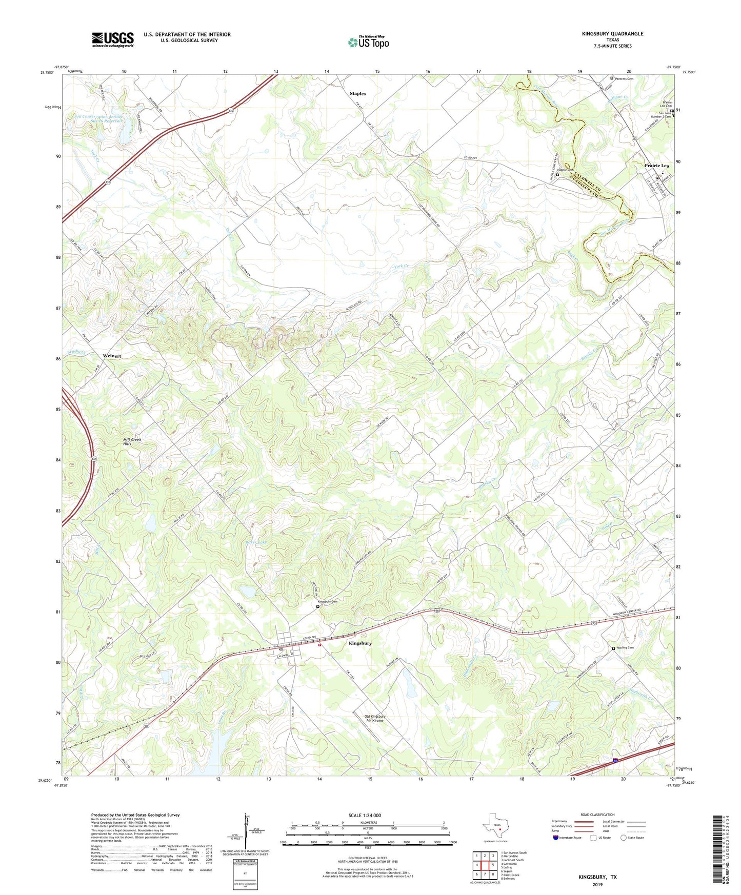
2019 topographic map quadrangle Kingsbury in the state of Texas. Scale: 1:24000. Based on the newly updated USGS 7.5' US Topo map series, this map is in the following counties: Guadalupe, Caldwell. The map contains contour data, water features, and other items you are used to seeing on USGS maps, but also has updated roads and other features. This is the next generation of topographic maps. Printed on high-quality waterproof paper with UV fade-resistant inks.
Quads adjacent to this one:
West: Geronimo
Northwest: San Marcos South
North: Martindale
Northeast: Lockhart South
East: Luling
Southeast: Belmont
South: Darst Creek
Southwest: Seguin
Contains the following named places: Appling Cemetery, Baker Lake, Baker Lake Dam, Callihan Creek, Cottonwood Creek, Happle Cemetery, Kingsbury, Kingsbury Baptist Church, Kingsbury Cemetery, Kingsbury Census Designated Place, Kingsbury Post Office, Kingsbury Volunteer Fire Department, Mill Creek Hills, Northeast Guadalupe Division, Old Kingsbury Aerodrome, Pentress Cemetery, Prairie Lea, Prairie Lea Cemetery, Prairie Lea Post Office, San Juan Number 2 Cemetery, Soil Conservation Service Site 16 Dam, Soil Conservation Service Site 16 Reservoir, Sweet Canaan Church, Weinert, York Creek, York Creek Church, ZIP Codes: 78638, 78661