MyTopo
Martindale Texas US Topo Map
Couldn't load pickup availability
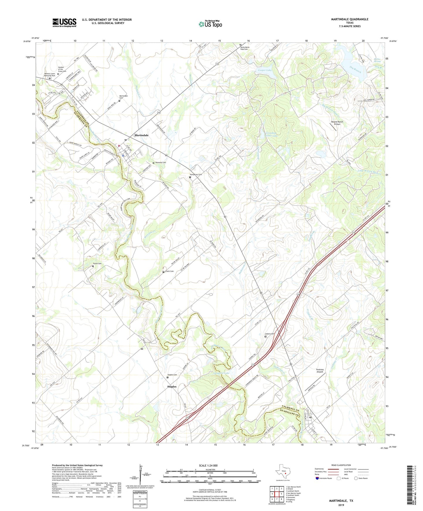
2022 topographic map quadrangle Martindale in the state of Texas. Scale: 1:24000. Based on the newly updated USGS 7.5' US Topo map series, this map is in the following counties: Caldwell, Guadalupe, Hays. The map contains contour data, water features, and other items you are used to seeing on USGS maps, but also has updated roads and other features. This is the next generation of topographic maps. Printed on high-quality waterproof paper with UV fade-resistant inks.
Quads adjacent to this one:
West: San Marcos South
Northwest: San Marcos North
North: Uhland
Northeast: Lockhart North
East: Lockhart South
Southeast: Luling
South: Kingsbury
Southwest: Geronimo
This map covers the same area as the classic USGS quad with code o29097g7.
Contains the following named places: Barber Springs, City of Martindale, City of Staples, Cliett Cemetery, Cooper Lake, Cooper Lake Dam, Crooked Branch, Dickerson Creek, Fentress, Fentress Airpark, Fentress Post Office, Garden of the Cross Cemetery, Grouskay-Fisher Lake, Grouskay-Fisher Lake Dam, Hemphill Creek, Humphrey Cemetery, Isidora Cemetery, Kennedy Cemetery, Langford Lake, Langford Lake Dam, Martindale, Martindale Cemetery, Martindale City Hall, Martindale Division, Martindale Police Department, Martindale Post Office, Martindale Volunteer Fire Department, Memory Lawn Memorial Park, Morrison Creek, Roland Ranch Airport, Santa Maria Aida Cemetery, Soil Conservation Service Site 34 Dam, Soil Conservation Service Site 34 Reservoir, Staples, Staples Cemetery, Staples Post Office, Tuttle Cemetery, ZIP Codes: 78622, 78655, 78670