
MyTopo
Knox City Texas US Topo Map
Couldn't load pickup availability
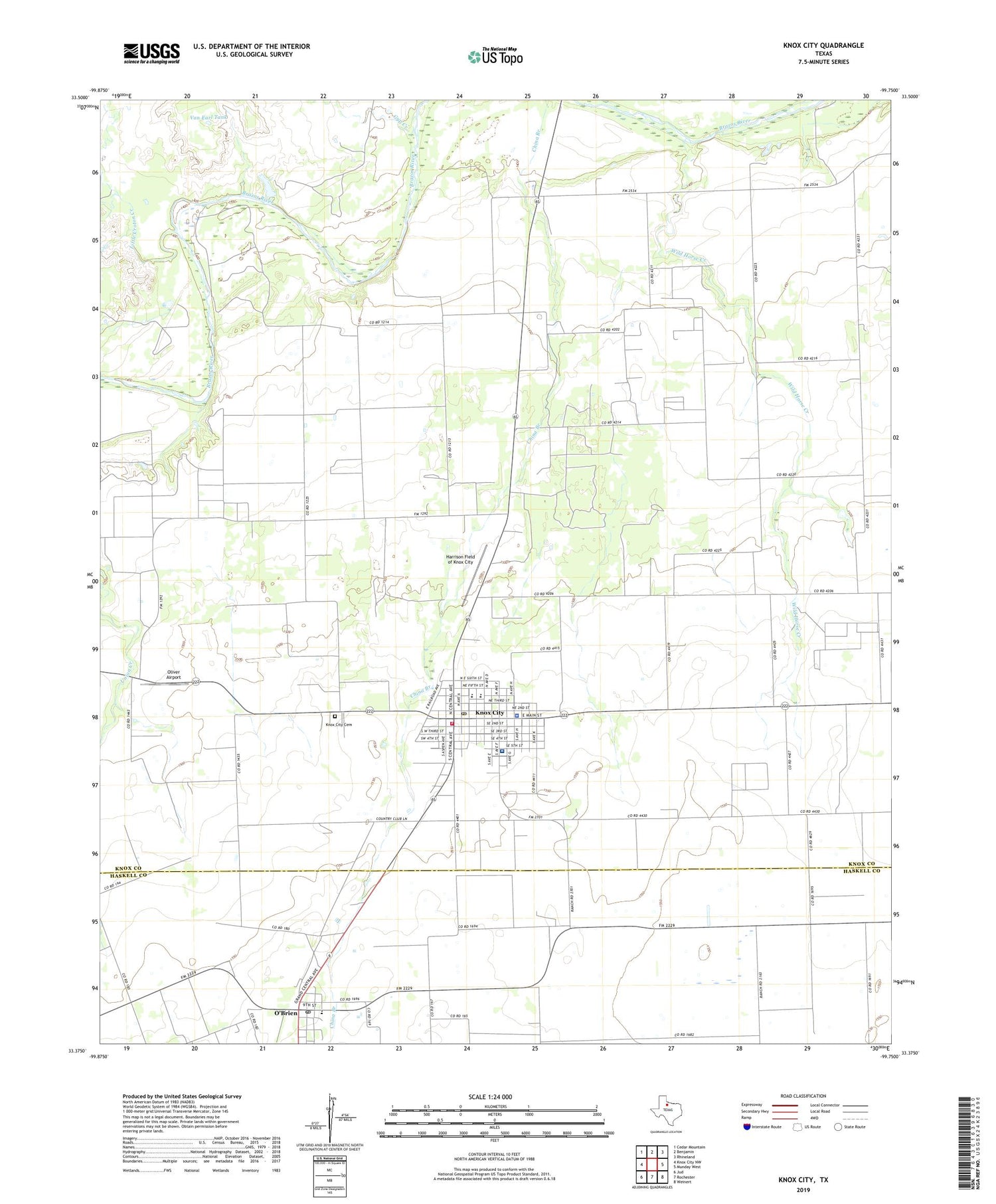
2019 topographic map quadrangle Knox City in the state of Texas. Scale: 1:24000. Based on the newly updated USGS 7.5' US Topo map series, this map is in the following counties: Knox, Haskell. The map contains contour data, water features, and other items you are used to seeing on USGS maps, but also has updated roads and other features. This is the next generation of topographic maps. Printed on high-quality waterproof paper with UV fade-resistant inks.
Quads adjacent to this one:
West: Knox City NW
Northwest: Cedar Mountain
North: Benjamin
Northeast: Rhineland
East: Munday West
Southeast: Weinert
South: Rochester
Southwest: Jud
Contains the following named places: Carney High School, Church of Christ, City of O'Brien, Clonts Lake, Clonts Lake Dam, Gyp Creek, Harrison Field of Knox City, Knox City, Knox City Cemetery, Knox City Country Club, Knox City Division, Knox City Fire Department, Knox City Hall, Knox City Police Department, Knox City Post Office, Knox County Hospital, Little Croton Creek, O'Brien, OBrien Post Office, Oliver Airport, Town of Knox City, Union Grove, Van Earl Tank, Wild Horse Creek, ZIP Code: 79529


