MyTopo
La Vernia SW Texas US Topo Map
Couldn't load pickup availability
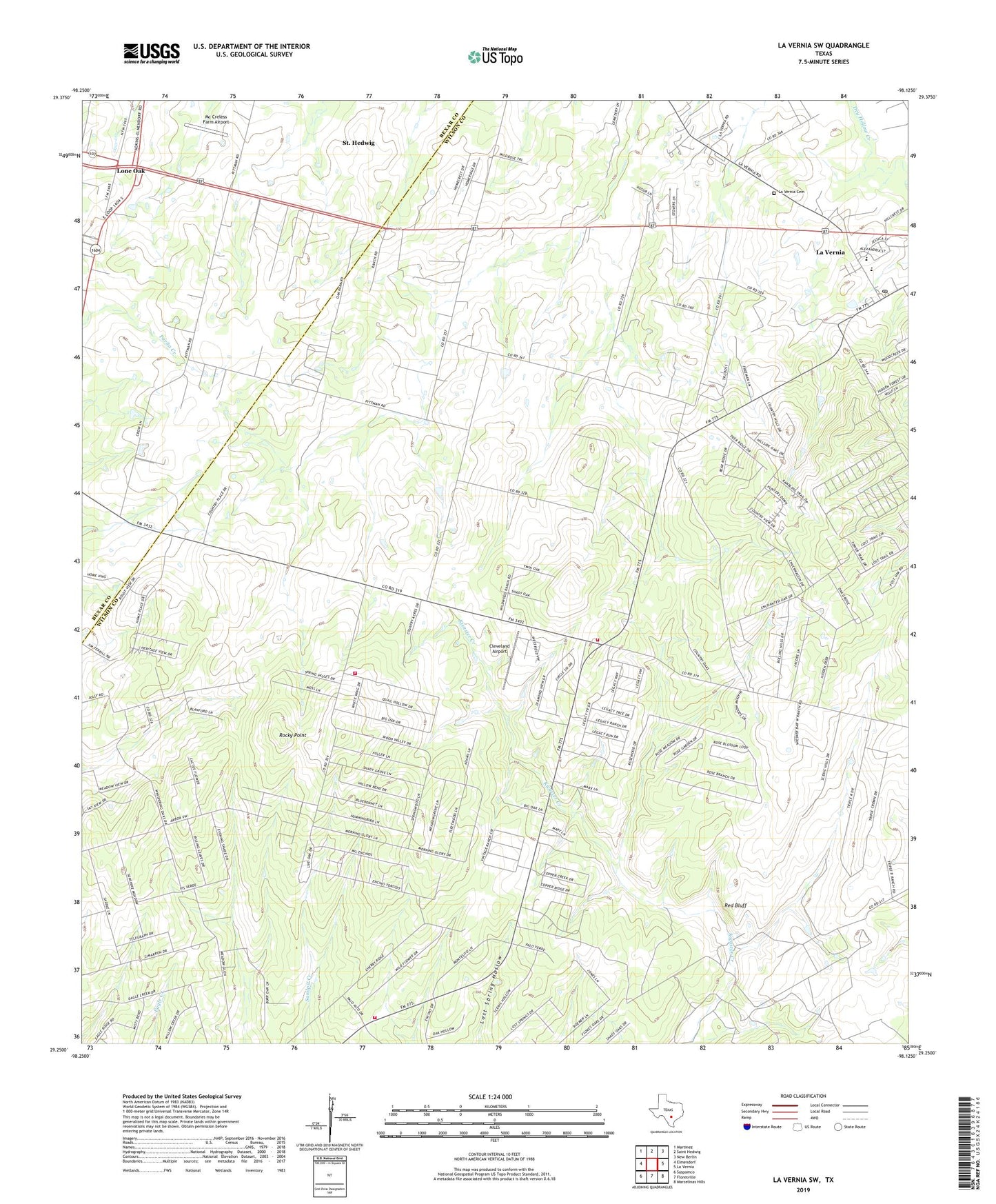
2019 topographic map quadrangle La Vernia SW in the state of Texas. Scale: 1:24000. Based on the newly updated USGS 7.5' US Topo map series, this map is in the following counties: Wilson, Bexar. The map contains contour data, water features, and other items you are used to seeing on USGS maps, but also has updated roads and other features. This is the next generation of topographic maps. Printed on high-quality waterproof paper with UV fade-resistant inks.
Quads adjacent to this one:
West: Elmendorf
Northwest: Martinez
North: Saint Hedwig
Northeast: New Berlin
East: La Vernia
Southeast: Marcelinas Hills
South: Floresville
Southwest: Saspamco
Contains the following named places: Cleveland Airport, Cooksey Oil Field, Eagle Creek Volunteer Emergency Services, Grass Pond Colony, Kicaster, Kicaster Volunteer Fire Department, La Vernia Cemetery, La Vernia Post Office, Lone Oak, Mc Creless Farm Airport, Red Bluff, Rocky Point, ZIP Code: 78101