
MyTopo
Laguna Vista Texas US Topo Map
Couldn't load pickup availability
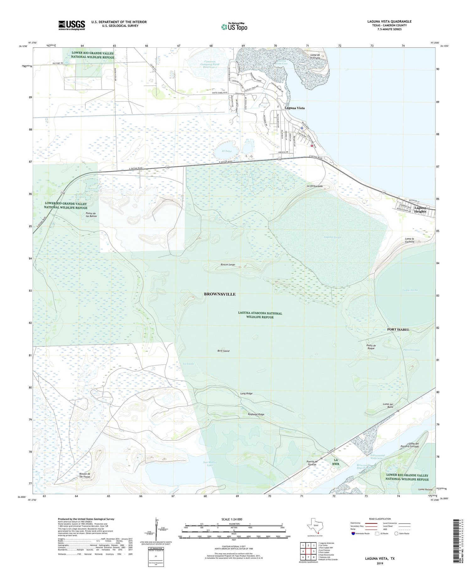
2019 topographic map quadrangle Laguna Vista in the state of Texas. Scale: 1:24000. Based on the newly updated USGS 7.5' US Topo map series, this map is in the following counties: Cameron. The map contains contour data, water features, and other items you are used to seeing on USGS maps, but also has updated roads and other features. This is the next generation of topographic maps. Printed on high-quality waterproof paper with UV fade-resistant inks.
Quads adjacent to this one:
West: Los Fresnos
Northwest: Laguna Atascosa
North: La Coma
Northeast: Port Isabel NW
East: Port Isabel
Southeast: Mouth of Rio Grande
South: Palmito Hill
Southwest: East Brownsville
Contains the following named places: Bahia Grande, Bird Island, Brownsville Ship Channel, Cameron Company Fwsd Reservoir 1, Cameron County Fwsd Dam 1, Carretas Crossing, City of Port Isabel Reservoir, El Tular, La Atravezada, La Aura Crossing, La Escale, Laguna Heights, Laguna Heights Census Designated Place, Laguna Larga, Laguna Vista, Laguna Vista Cove, Laguna Vista Police Department, Laguna Vista Public Library, Laguna Vista Town Hall, Laguna Vista Volunteer Fire Department, Loma de la Grulla, Loma del Ballo, Loma del Potrero Cercado, Loma la Cuchilla, Loma la Jauja, Long Ridge, Paso Corvinas, Posta de Roque, Puerta de Trancas, Punta de las Bahias, Redhead Ridge, Rincon de las Viejas, Rincon Largo, Rutherford-Harding Addition Colonia, San Martin Lake, Town of Laguna Vista, Vadia Ancha, ZIP Code: 78578


