MyTopo
Laguna Atascosa Texas US Topo Map
Couldn't load pickup availability
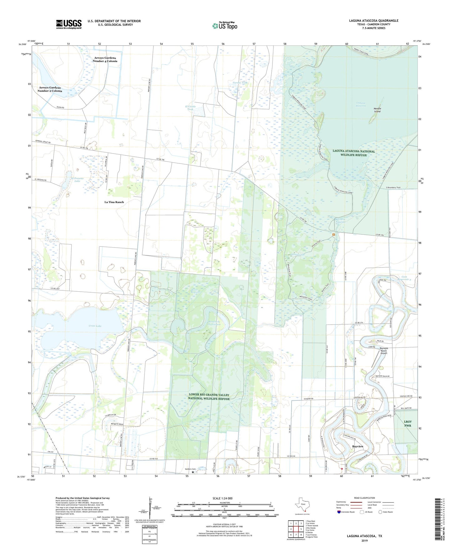
2022 topographic map quadrangle Laguna Atascosa in the state of Texas. Scale: 1:24000. Based on the newly updated USGS 7.5' US Topo map series, this map is in the following counties: Cameron. The map contains contour data, water features, and other items you are used to seeing on USGS maps, but also has updated roads and other features. This is the next generation of topographic maps. Printed on high-quality waterproof paper with UV fade-resistant inks.
Quads adjacent to this one:
West: Rio Hondo
Northwest: Paso Real
North: La Leona
Northeast: Three Islands
East: La Coma
Southeast: Laguna Vista
South: Los Fresnos
Southwest: Olmito
This map covers the same area as the classic USGS quad with code o26097b4.
Contains the following named places: Alfredo Garza Colonia, Arroyo Gardens, Arroyo Gardens Number 2 Colonia, Arroyo Gardens Number 4 Colonia, Arroyo Gardens-La Tina Ranch Census Designated Place, Bayview, Cain Dam 2, Cain Reservoir 2, Cameron County, Cross Lake, East Fresnos Colonia, El Civolo Tank, El Preseno Lake, Espuela Tank, Esquina Colonia, Gumesindo Galvan Colonia, Hormigas Lake, Juan Gonzales Colonia, La Tina, La Tina Ranch, La Tina Ranch Census Designated Place, Laguna Atascosa, Leonar B De Villarreal Colonia, Los Fresnos Fire Department, Lourdes Street Colonia, Mercer Dry Reservoir Levee, Mercer Reservoir 1, Mercer Reservoir 1 Levee, Mercer Reservoir 2, Mercer Reservoir 2 Dam, Needle Island, Resaca de los Fresnos, Reservoir Number Seven, Reynolds Ranch Airport, Soldiers Cemetery, Sweeney Lake East Levee, Sweeney Lake West Dam, Town of Bayview, Vareno Tank, Vicente Sandoval Colonia