MyTopo
La Coma Texas US Topo Map
Couldn't load pickup availability
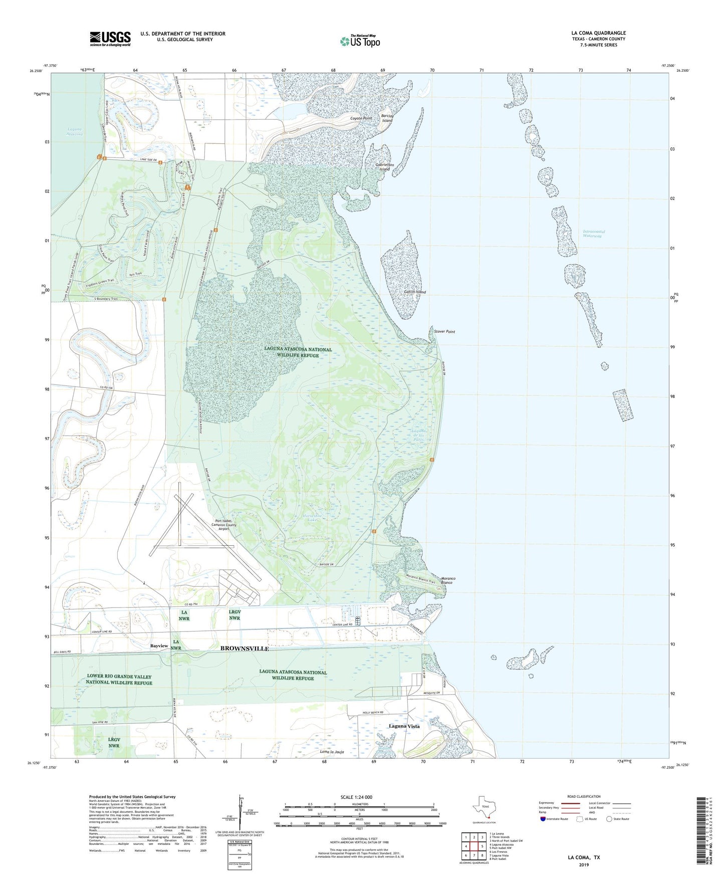
2022 topographic map quadrangle La Coma in the state of Texas. Scale: 1:24000. Based on the newly updated USGS 7.5' US Topo map series, this map is in the following counties: Cameron. The map contains contour data, water features, and other items you are used to seeing on USGS maps, but also has updated roads and other features. This is the next generation of topographic maps. Printed on high-quality waterproof paper with UV fade-resistant inks.
Quads adjacent to this one:
West: Laguna Atascosa
Northwest: La Leona
North: Three Islands
Northeast: North of Port Isabel SW
East: Port Isabel NW
Southeast: Port Isabel
South: Laguna Vista
Southwest: Los Fresnos
This map covers the same area as the classic USGS quad with code o26097b3.
Contains the following named places: Barclay Island, Buena Vista, Buena Vista Ranch, Cain Dam 1, Cain Reservoir 1, Coyote Point, East Cameron Division, Gabrielson Island, Gatlin Island, Granjeno Ranch, Holly Beach, Horseshoe Lake, La Coma Ranch, Laguna Atascosa National Wildlife Refuge, Laguna de los Patos, Light Eightynine, Light Fiftynine, Light Seventynine, Light Sixtynine, Moranco Blanco, Port Isabel Air Force Station, Port Isabel Naval Auxiliary Air Station, Port Isabel-Cameron County Airport, Resaca de la Gringa, Resaca de los Cuates, Stover Cove, Stover Point, ZIP Codes: 78566, 78597