MyTopo
Leona SW Texas US Topo Map
Couldn't load pickup availability
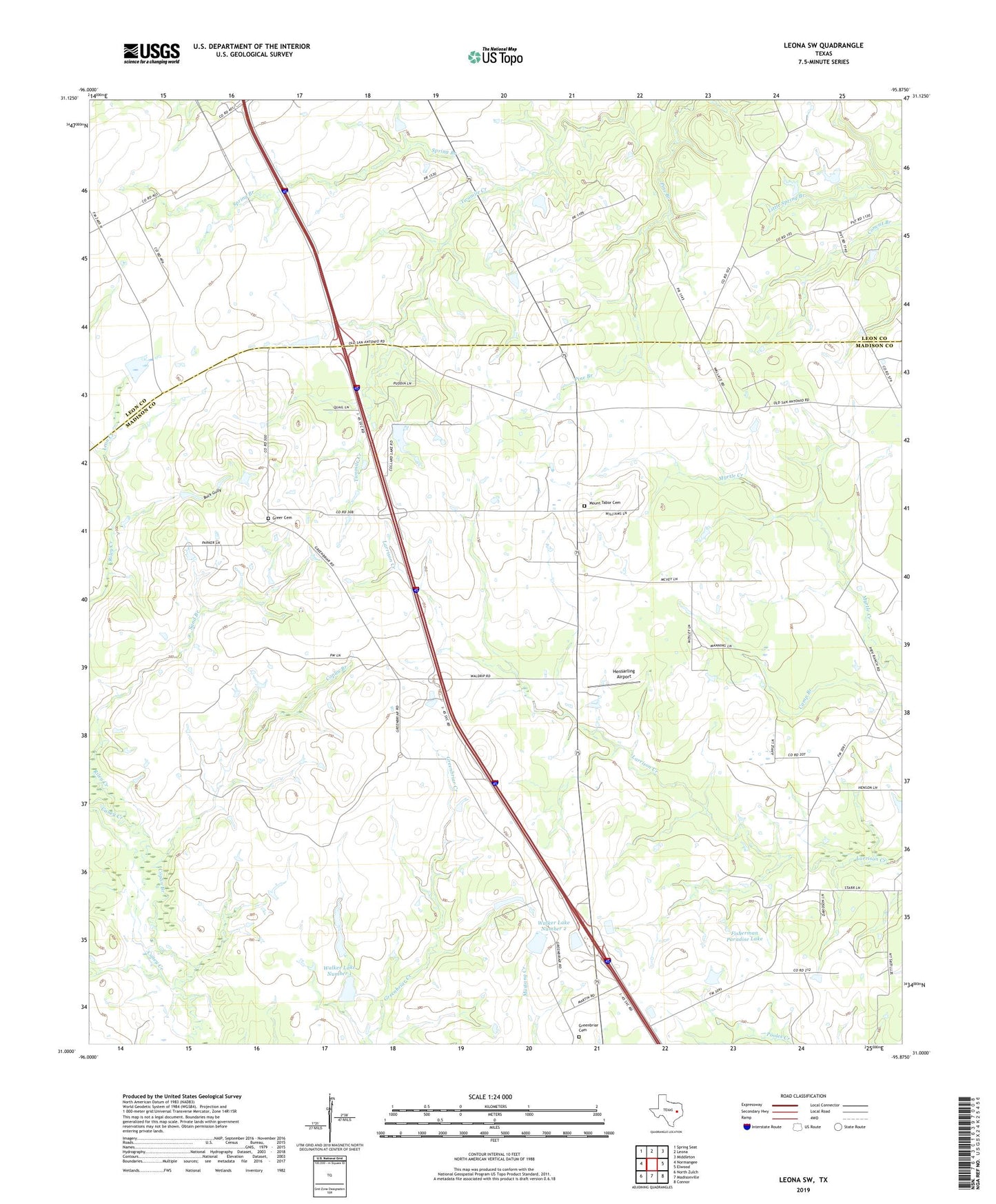
2019 topographic map quadrangle Leona SW in the state of Texas. Scale: 1:24000. Based on the newly updated USGS 7.5' US Topo map series, this map is in the following counties: Madison, Leon. The map contains contour data, water features, and other items you are used to seeing on USGS maps, but also has updated roads and other features. This is the next generation of topographic maps. Printed on high-quality waterproof paper with UV fade-resistant inks.
Quads adjacent to this one:
West: Normangee
Northwest: Spring Seat
North: Leona
Northeast: Middleton
East: Elwood
Southeast: Connor
South: Madisonville
Southwest: North Zulch
Contains the following named places: Buck Gully, Concord Community Building, Coplin Branch, Cross Roads, Fisherman Paradise Lake, Fisherman Paradise Lake Dam, Greenbriar Cemetery, Greer Cemetery, Hensarling Airport, Leon Creek, Middle Branch Riley Creek, Mount Tabor Cemetery, OSR Oil Field, Riley Creek, Sand Branch, Seven J Ranch, Spring Branch, Sweet Home Church, Tabor Church, Walker Lake Number 1, Walker Lake Number 1 Dam, Walker Lake Number 2, Walker Lake Number 2 Dam