MyTopo
Elwood Texas US Topo Map
Couldn't load pickup availability
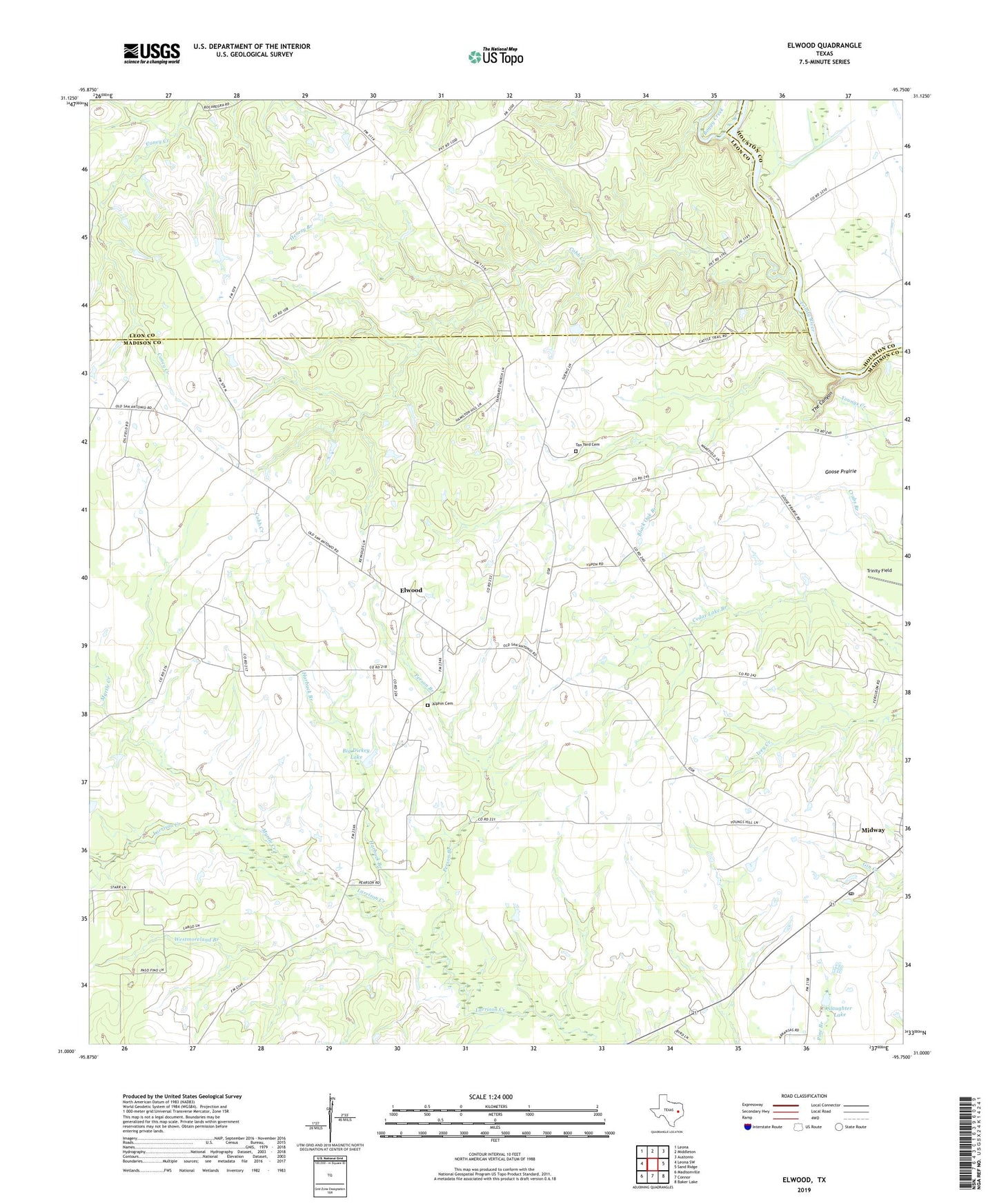
2022 topographic map quadrangle Elwood in the state of Texas. Scale: 1:24000. Based on the newly updated USGS 7.5' US Topo map series, this map is in the following counties: Madison, Leon, Houston. The map contains contour data, water features, and other items you are used to seeing on USGS maps, but also has updated roads and other features. This is the next generation of topographic maps. Printed on high-quality waterproof paper with UV fade-resistant inks.
Quads adjacent to this one:
West: Leona SW
Northwest: Leona
North: Middleton
Northeast: Austonio
East: Sand Ridge
Southeast: Baker Lake
South: Connor
Southwest: Madisonville
This map covers the same area as the classic USGS quad with code o31095a7.
Contains the following named places: Alphin Cemetery, Big Dickey Lake, Black Oak Branch, Boggy Creek, Camp Branch, City of Midway, Cobb Creek, Convict Branch, Dingerville, Elwood, Goose Prairie, Harbuck Branch, Henesy Branch, Little Spring Branch, Midway, Midway Post Office, Myrtle Creek, Old Elwood, Person Branch, Slaughter Lake, Slaughter Lake Dam, Tan Yard, Tan Yard Cemetery, The Canyon, Westmoreland Branch, Wilson Chapel