MyTopo
Spring Seat Texas US Topo Map
Couldn't load pickup availability
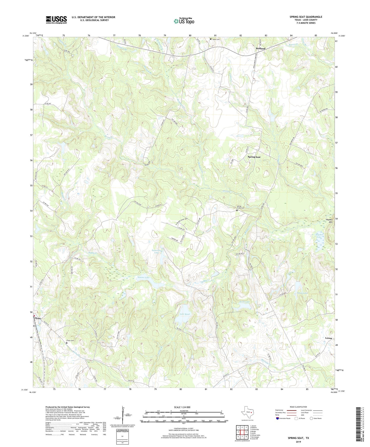
2022 topographic map quadrangle Spring Seat in the state of Texas. Scale: 1:24000. Based on the newly updated USGS 7.5' US Topo map series, this map is in the following counties: Leon. The map contains contour data, water features, and other items you are used to seeing on USGS maps, but also has updated roads and other features. This is the next generation of topographic maps. Printed on high-quality waterproof paper with UV fade-resistant inks.
Quads adjacent to this one:
West: Margie
Northwest: Jewett
North: Robbins
Northeast: Centerville
East: Leona
Southeast: Leona SW
South: Normangee
Southwest: Hilltop Lakes
This map covers the same area as the classic USGS quad with code o31096b1.
Contains the following named places: Bethanna Church, Boyd Branch, Buzzard Branch, Cryar Lake, Easterling Lake, Easterling Lake Dam, Evans Chapel, Flynn, Flynn Cemetery, Flynn Post Office, Flynn Volunteer Fire Department, Greer Branch, Hayden Lake, Hayden Mountain, Herbert Cryar Dam, Keith Lake, Keith Lake Dam, Lake Reed, Lake Reed Dam, McDaniel Creek, Nixon Branch, Redland, Redland Church, Seale Cemetery, Simms Lake, Simms Lake Dam, Smith Lake, Smith Lake Dam, Spring Creek, Spring Creek Cemetery, Spring Seat, Yellow Branch