MyTopo
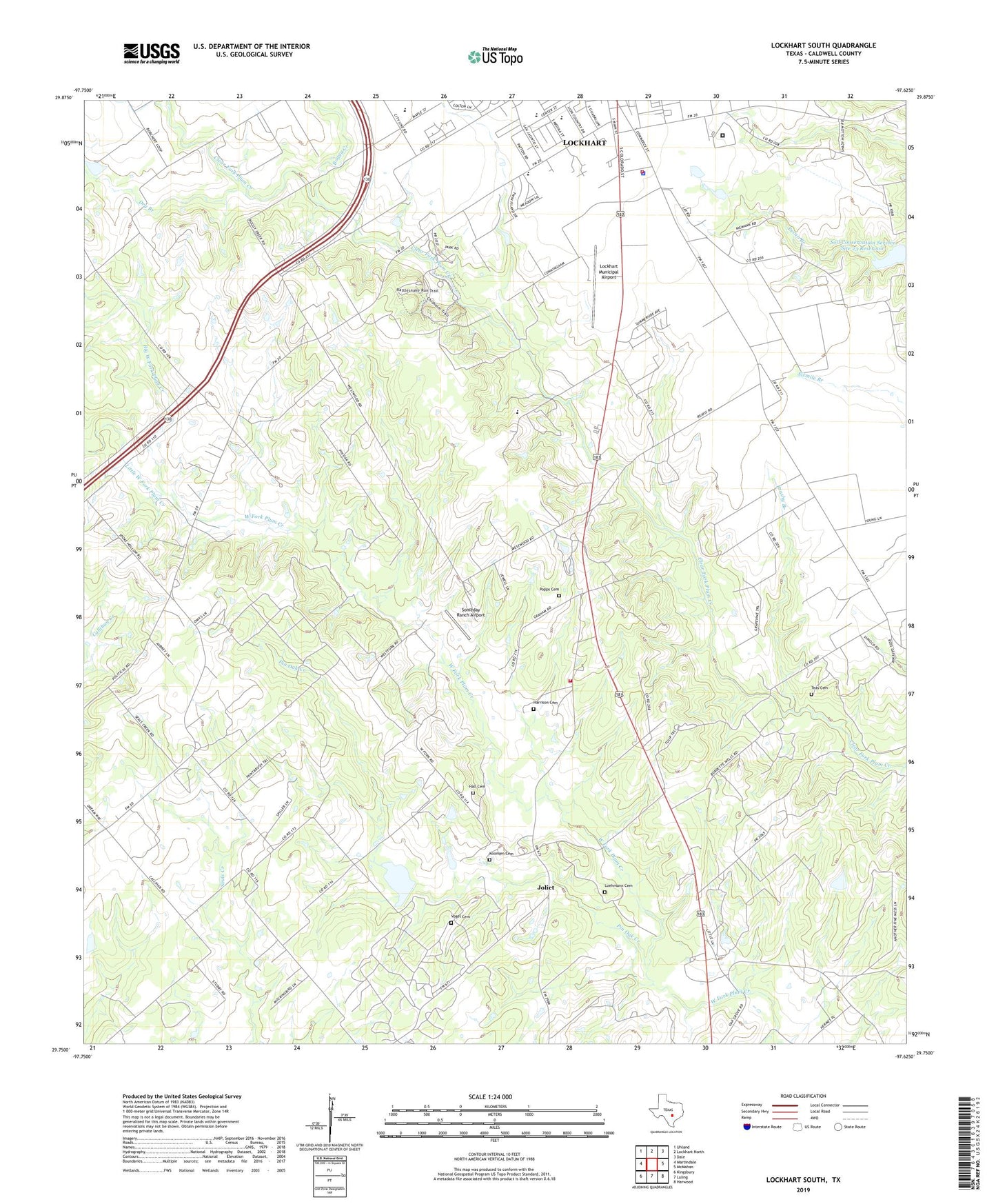
Lockhart South Texas US Topo Map
Couldn't load pickup availability
2019 topographic map quadrangle Lockhart South in the state of Texas. Scale: 1:24000. Based on the newly updated USGS 7.5' US Topo map series, this map is in the following counties: Caldwell. The map contains contour data, water features, and other items you are used to seeing on USGS maps, but also has updated roads and other features. This is the next generation of topographic maps. Printed on high-quality waterproof paper with UV fade-resistant inks.
Quads adjacent to this one:
West: Martindale
Northwest: Uhland
North: Lockhart North
Northeast: Dale
East: McMahan
Southeast: Harwood
South: Luling
Southwest: Kingsbury
Contains the following named places: Big West Fork Plum Creek, Boggy Creek, Brushy Branch, Caldwell County Medical Assist Team, City of Lockhart Emergency Medical Services, Dry Branch, Golden Age Home, Hall Family Cemetery, Harrison Cemetery, Joliet, Koonsen Cemetery, Little West Fork Plum Creek, Lockhart Fire / Rescue Station 2, Lockhart Municipal Airport, Lockhart Police Department, Lockhart State Park, Lockhart State Park Trail, Loehmann Cemetery, Luling Oil Field, M A Withers House, Mid - county Volunteer Fire Department, Mineral Springs, Mineral Springs Church, Pin Oak Creek, Popps Cemetery, Saint Johns United Baptist Church, Soil Conservation Service Site 23 Dam, Soil Conservation Service Site 23 Reservoir, Soil Conservation Service Site 37 Dam, Soil Conservation Service Site 37 Reservoir, Someday Ranch Airport, Teas Cemetery, Texas Department of Criminal Justice Lockhart Correctional Facility, Vogel Cemetery, ZIP Code: 78644