MyTopo
Lockhart North Texas US Topo Map
Couldn't load pickup availability
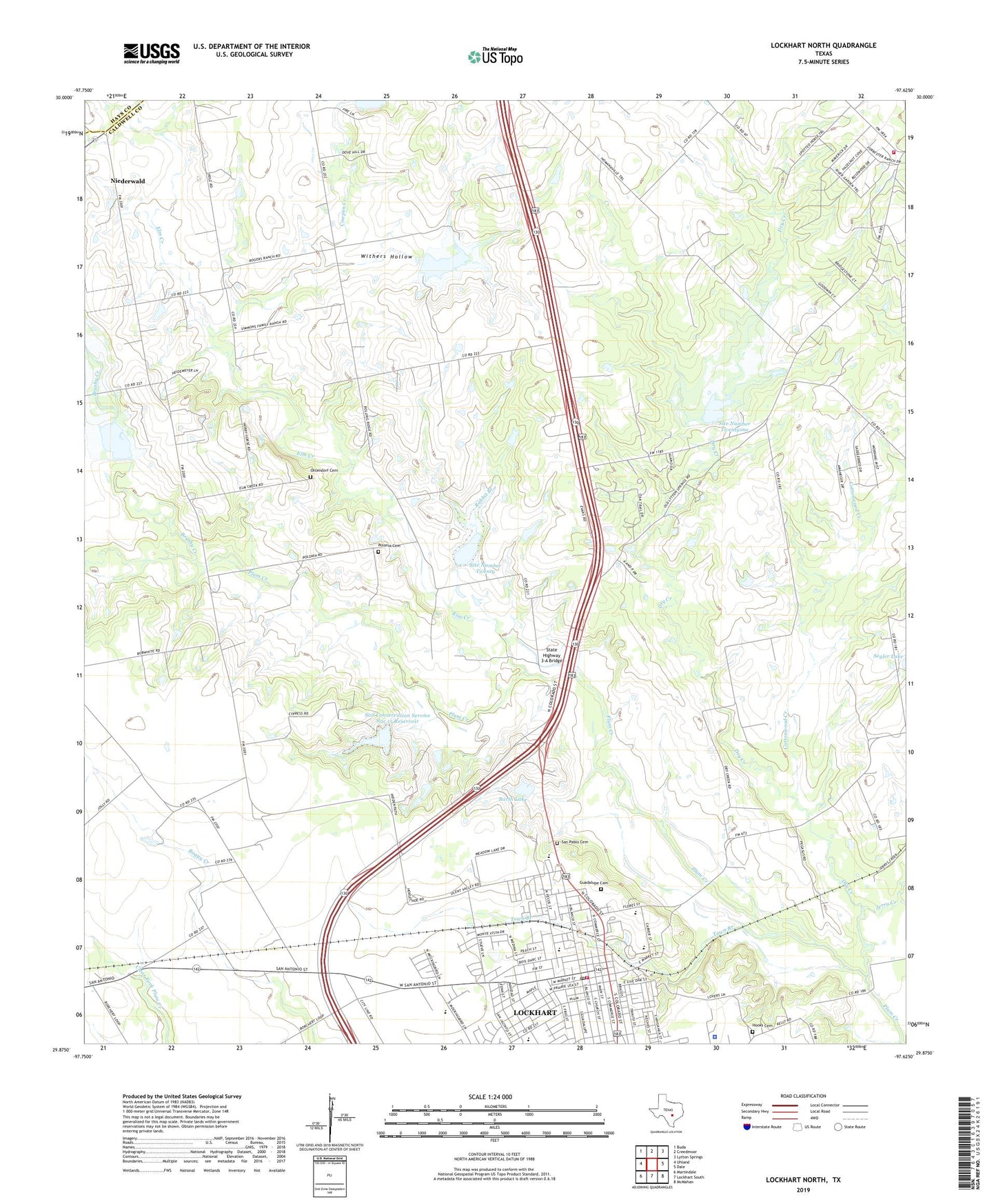
2022 topographic map quadrangle Lockhart North in the state of Texas. Scale: 1:24000. Based on the newly updated USGS 7.5' US Topo map series, this map is in the following counties: Caldwell, Hays. The map contains contour data, water features, and other items you are used to seeing on USGS maps, but also has updated roads and other features. This is the next generation of topographic maps. Printed on high-quality waterproof paper with UV fade-resistant inks.
Quads adjacent to this one:
West: Uhland
Northwest: Buda
North: Creedmoor
Northeast: Lytton Springs
East: Dale
Southeast: McMahan
South: Lockhart South
Southwest: Martindale
This map covers the same area as the classic USGS quad with code o29097h6.
Contains the following named places: American Indian Horse Museum, Barth Lake, Barth Lake Dam, Brazos Street Baptist Church, Brooks Place Airport, Brushy Creek, Caldwell County Constable's Office Precinct 1, Caldwell County Constable's Office Precinct 4, Caldwell County Courthouse Historic District, Caldwell County Jail, Caldwell County Museum, Caldwell County Sheriff's Office, Carver High School, Carver School, Center Union Missionary Church, Chisholm Trail Fire and Rescue Station 3, Church of Christ, City of Lockhart, Cottonwood Creek, Cowpen Creek, Dry Creek, Elm Creek, Emmanuel Episcopal Church, First Apostolic Church, First Presbyterian Church, Guadalupe Cemetery, Hooks Cemetery, Jerry Creek, KFIT-AM (Lockhart), Lockhart, Lockhart City Hall, Lockhart City Park, Lockhart Division, Lockhart Fire Rescue Department Station 1, Lockhart Junior High School, Lockhart Post Office, Lockhart Vocational High School, Mason Lone Oak Baptist Church, Ohlendorf Cemetery, Plum Creek Elementary School, Polonia Cemetery, Pride School, Rabbit Branch, Saint James African Methodist Episcopal Church, Saint Marks United Methodist Church, San Pablo Cemetery, Second Presbyterian Church, Segler Lake Dam, Site Number Eighteen, Site Number Fifteen, Site Number Twenty, Site Number Twentyone, Soil Conservation Service Site 14 Dam, Soil Conservation Service Site 14 Reservoir, Soil Conservation Service Site 15 Dam, Soil Conservation Service Site 15 Reservoir, Soil Conservation Service Site 18 Dam, Soil Conservation Service Site 18 Reservoir, Soil Conservation Service Site 20 Dam, Soil Conservation Service Site 21 Dam, State Highway 3-A Bridge, Town Branch, Trinity Baptist Church, Withers Hollow