MyTopo
Lott Lake Texas US Topo Map
Couldn't load pickup availability
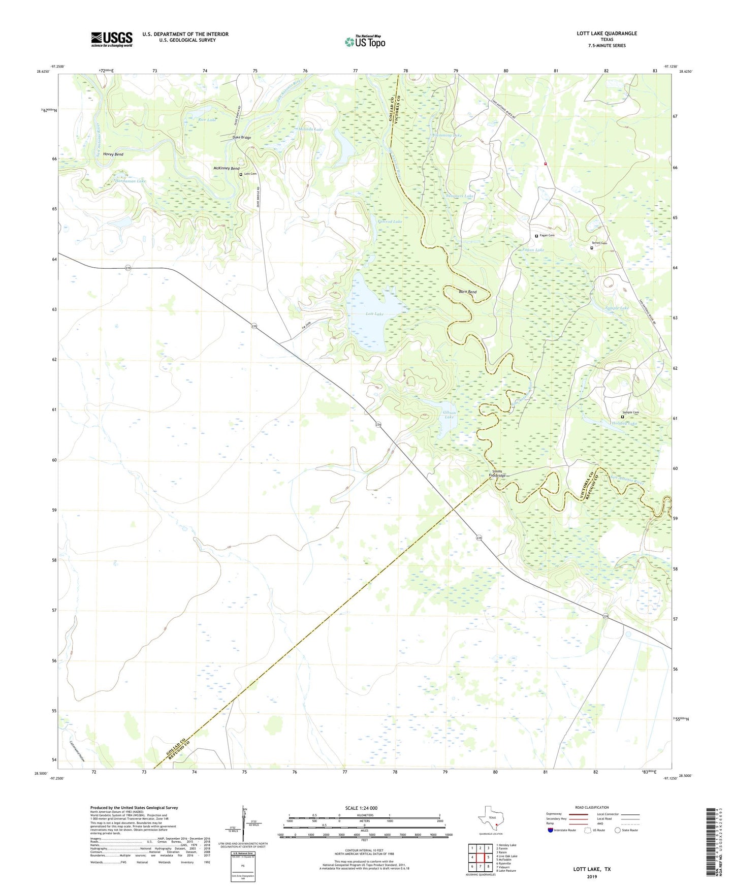
2019 topographic map quadrangle Lott Lake in the state of Texas. Scale: 1:24000. Based on the newly updated USGS 7.5' US Topo map series, this map is in the following counties: Goliad, Refugio, Victoria. The map contains contour data, water features, and other items you are used to seeing on USGS maps, but also has updated roads and other features. This is the next generation of topographic maps. Printed on high-quality waterproof paper with UV fade-resistant inks.
Quads adjacent to this one:
West: Live Oak Lake
Northwest: Hensley Lake
North: Fannin
Northeast: Raisin
East: McFaddin
Southeast: Lake Pasture
South: Vidaurri
Southwest: Ryanville
Contains the following named places: Burn Bend, Duke Bridge, Fagan Cemetery, Fagan Lake, Flemming Lake, Fulcrod Lake, Gaffney Oil Field, Gibson Lake, Hardaman Lake, Holiday Lake, Hovey Bend, Lott Cemetery, Lott Lake, McKinney Bend, Milinda Lake, Mount Zion Church, Raisin Volunteer Fire Department Station 3, Redding Lake, Rice Lake, Sample Cemetery, Sample Lake, Simms Footbridge, Summers Lake, Terrell Cemetery