
MyTopo
Lueders East Texas US Topo Map
Couldn't load pickup availability
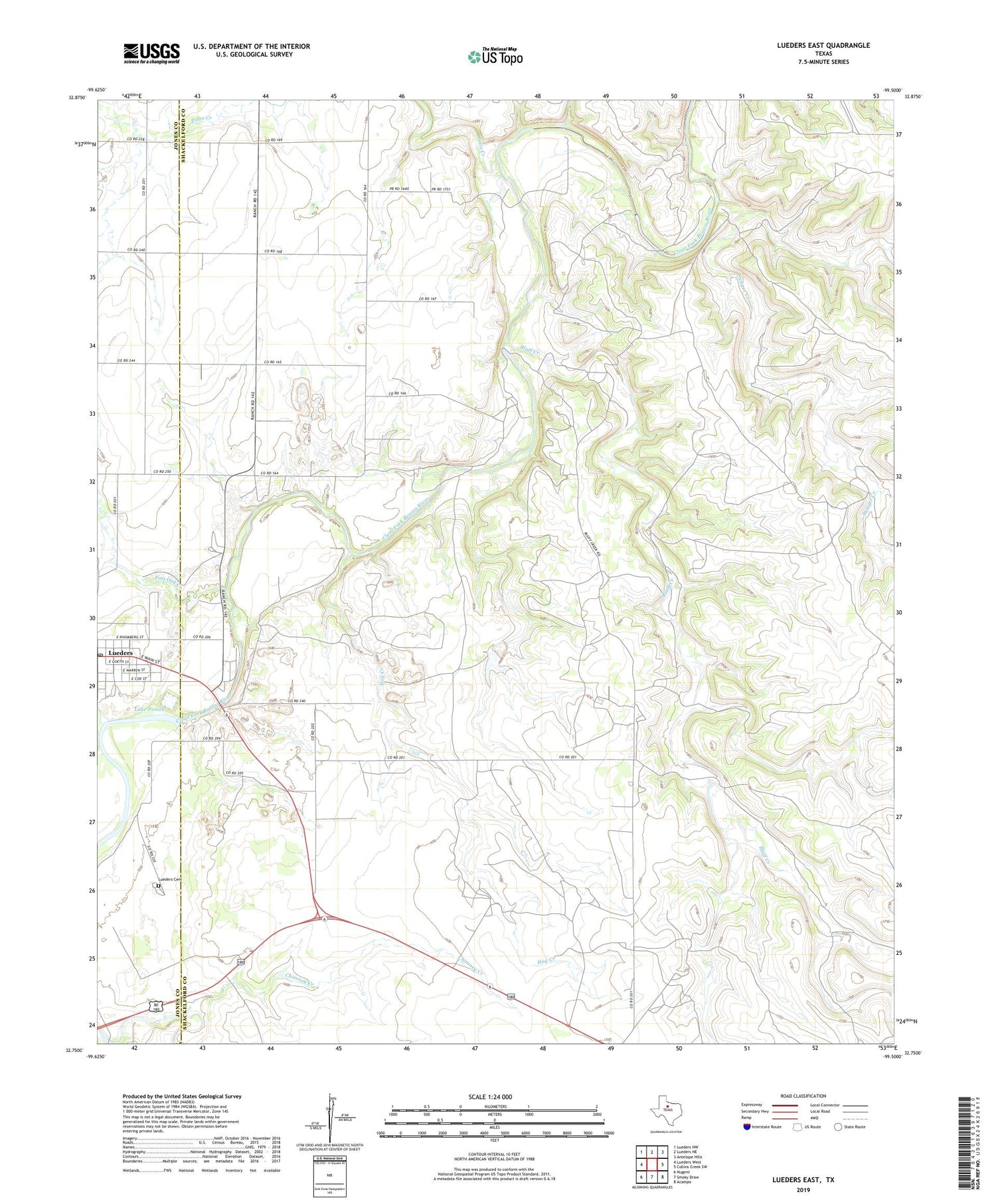
2019 topographic map quadrangle Lueders East in the state of Texas. Scale: 1:24000. Based on the newly updated USGS 7.5' US Topo map series, this map is in the following counties: Shackelford, Jones. The map contains contour data, water features, and other items you are used to seeing on USGS maps, but also has updated roads and other features. This is the next generation of topographic maps. Printed on high-quality waterproof paper with UV fade-resistant inks.
Quads adjacent to this one:
West: Lueders West
Northwest: Lueders NW
North: Lueders NE
Northeast: Antelope Hills
East: Collins Creek SW
Southeast: Acampo
South: Smoky Draw
Southwest: Nugent
Contains the following named places: Bluff Creek, Chimney Creek, City of Lueders, Cottonwood Creek, Hog Creek, Lake Penick, Lake Penick Dam, Lueders, Lueders Cemetery, Lueders City Hall, Lueders Encampment, Lueders Post Office, Pinto Creek, Post Oak Creek, Swager Creek, ZIP Code: 79533


