MyTopo
Lueders NE Texas US Topo Map
Couldn't load pickup availability
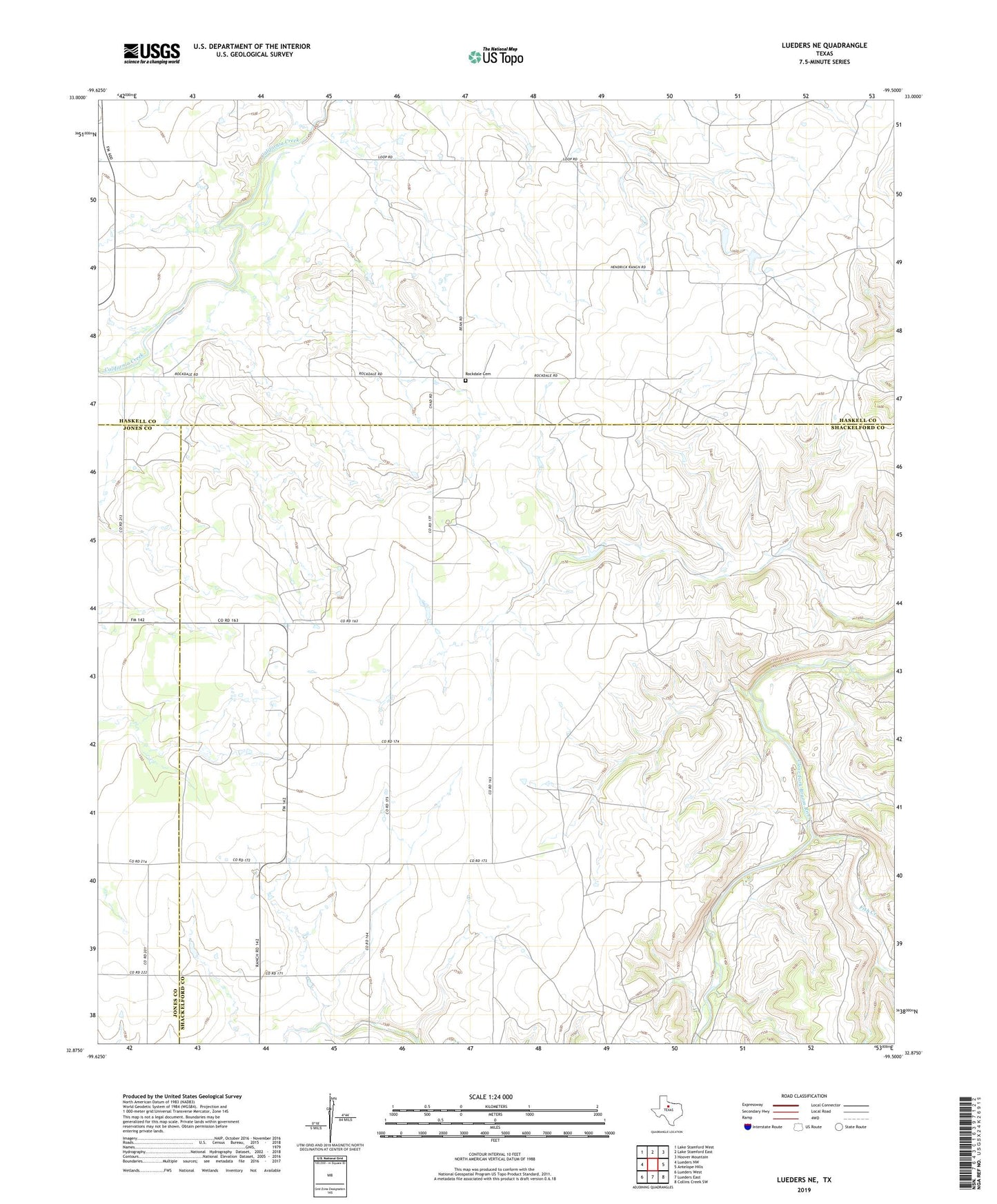
2022 topographic map quadrangle Lueders NE in the state of Texas. Scale: 1:24000. Based on the newly updated USGS 7.5' US Topo map series, this map is in the following counties: Shackelford, Haskell, Jones. The map contains contour data, water features, and other items you are used to seeing on USGS maps, but also has updated roads and other features. This is the next generation of topographic maps. Printed on high-quality waterproof paper with UV fade-resistant inks.
Quads adjacent to this one:
West: Lueders NW
Northwest: Lake Stamford West
North: Lake Stamford East
Northeast: Hoover Mountain
East: Antelope Hills
Southeast: Collins Creek SW
South: Lueders East
Southwest: Lueders West
This map covers the same area as the classic USGS quad with code o32099h5.
Contains the following named places: Berryhill, Berryhill School, Fish Creek, Hendrick Ranch, Lindsay Chapel, Rockdale Cemetery, Rockdale Church