
MyTopo
Mansfield Texas US Topo Map
Couldn't load pickup availability
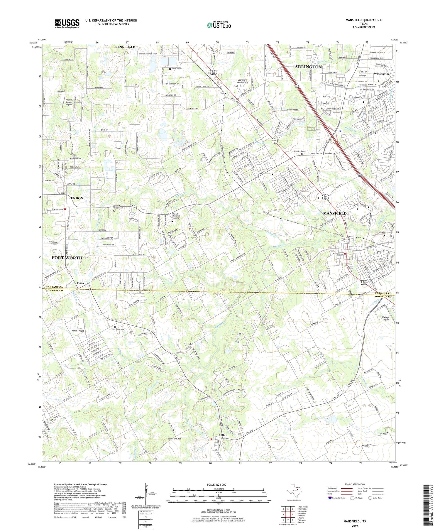
2019 topographic map quadrangle Mansfield in the state of Texas. Scale: 1:24000. Based on the newly updated USGS 7.5' US Topo map series, this map is in the following counties: Tarrant, Johnson. The map contains contour data, water features, and other items you are used to seeing on USGS maps, but also has updated roads and other features. This is the next generation of topographic maps. Printed on high-quality waterproof paper with UV fade-resistant inks.
Quads adjacent to this one:
West: Burleson
Northwest: Fort Worth
North: Kennedale
Northeast: Arlington
East: Britton
Southeast: Venus
South: Alvarado
Southwest: Keene
Contains the following named places: Alice Ponder Elementary School, Alpine Range Airport, Bible Baptist Church of Rendon, Bisbee, Bludworth School, Carousel Farms Lake, Carousel Farms Lake Dam, Cedar Hill Memorial Park, Center for Behavior Management, Central Baptist Church, Church of Christ Mansfield, Cope Cemetery, Cross Timbers Intermediate School, East Balancing Reservoir, East Balancing Reservoir Dam, Erma Nash Elementary School, First Church of the Nazarene, First United Methodist Church of Mansfield, Flying L Airpark, Flying W Heliport, Grimsley Cemetery, Hess Airport, Hudson Cemetery, James McKnight Park Trail, Johnson County Emergency Services Department Station 82, Kindred Hospital - Mansfield, King Branch, Lillian, Lillian Post Office, Mansfield, Mansfield Alternative Education Center, Mansfield City Hall, Mansfield Community Church, Mansfield Fire Department Station 1, Mansfield Post Office, Mansfield School, Napiers Heliport, Nash School, New Hope Church, New Zion Missionary Baptist Church, Pleasant Point Church, Poverty Knob, Powerhouse Church, R L Anderson Stadium, Rendon, Rendon Census Designated Place, Rendon Church, Rendon Church of Christ, Rendon Fire Department, Retta, Retta Airport, Rogene Worley Middle School, Saint Gregorys Episcopal Church, Short Field, Skyvue Memorial Gardens, Southwest Custom Aircraft Heliport, Sweethome Church of God in Christ, T A Howard Middle School, Tabernacle Baptist Church of Rendon, Tarrant County Constable's Office Precinct 7, Tarver - Rendon Elementary School, Trans - Care Medical Transport, Trinity Presbyterian Church, Valley Branch, Valley Ridge, Walnut Creek Cemetery, Walnut Creek Church of God, Watsonville, WBAP-AM (Fort Worth), West Balancing Reservior Dam, West Balancing Reservoir, Willow Branch, ZIP Codes: 76061, 76063


